Thursday, December 17, 2015

One man's trash ... is another man's trash

Microtrash is always a big problem, and rare is the trip I take without coming home with a cargo-pants pocket full of it.  Common offenders are cigarette butts, corners of Clif/Snickers/Nature Valley bars, crumbs of those ubiquitous blue foam pads, and the occasional bandaid.  Note, I never pick up toilet paper, so ladies, please try and pee farther away than right next to the trail.

Macrotrash is a little more of an interesting dilemma.   You see either modern dumpsites at trailheads (tires, beer cans) or you find 'historic' items rusting away at an old cabin site, or the remains of a can dump at an old shelter.   Sometimes its piles of trash, and unsightly, or its in high traffic areas where it encourages more trash.   Here's a case where a very busy caretaker in the Maine Applachian Trail Club cleaned up a massive amount of really bad trash.   I helped carry down some big rusty iron bits on my way down the Firewarden's Trail (totally overwhelming my pack's suspension, but worth it).
http://www.matc.org/assets/Resolved-Refuse-Removal-ATJourneys-MarApr2014.pdf


I can live with some of it, things like this I found in the desert of southern California.   It adds a certain atmosphere, and has some historical value.   This area was actively mined for gold.


But what kills me is the modern "woodsman's" trash.  Plastic garbage bags left behind.   Propane cannisters.   Toilet paper.  5 gallon buckets of poop.   Benches, tables, chairs hacked together with local lumber and plywood.   When I was a caretaker on the AT in Maine, I once packed out nearly a full black trashbag, just from a single hike ~40 miles and hitting 3 shelters.  Unacceptable!

These are the things that say "This area is actively used.   It is not wild, whatever you thought you were going to see.   It's a campsite, a playground, a city park.   It's to be used and consumed, not preserved or saved for the next person.   We beat you to it, so suck it."

Monday, December 7, 2015

Leaving no trace in paradise

Digging through some old hiking photos from Hawaii, I was struck how similar the trail is to New England, despite having probably 1/100 of the traffic.   That volcanic soil just can't take the abuse, similar to the thin layer of soil on top of the mineral soils covering the mountains of the Northeast.  Just like how in alpine zones like Marcy, Washington, Saddleback and Katahdin one step off the trail does irreparable damage, the terrain on relatively 'new' land like the Hawaiian islands is fragile.

First you have jackasses like this.   Despite a marked trail, an easy trail that doesn't need poles, a sign to stay on the trail, these  two decided to take a break off the trail to adjust.   The terrain seems hardly fragile, but it's the sense of wildness you're looking to preserve.   If you end up with footbeds all over the lava, then its not a cool dormant crater anymore, its a city park.


On Kauai, in the Waimea Canyon park, there's a long trail that runs through jungle then along the coast.    Here you have a hip-deep trail, and a "bonus" trail along the side, probably created by sneaker-wearing hikers in the wet season.   If you #PlanAheadAndPrepare you have the right shoes.


When the trail is eroded like this, you want to stay on it - and you can see the subtle psychological pressure to keep away from the edge; the soil is getting compacted as the trail erodes.


These are the only legitimate ones allowed to go off-trail.   Partially because they live here, partially because they have four wheel drive.


It's important to leave the land in the condition you've found it, as you owe it to the guy behind you.   Let him have his experience, just as you had yours, and perhaps next time, someone will leave something for you.

Monday, November 23, 2015

And then there were three

A northern white rhino has died in a zoo in the US, leaving 3 left in the world (in Kenya).


The remaining ones are locked away in a preserve, so that men with small penises will not kill them and consume their horns.

http://www.olpejetaconservancy.org/wildlife/rhinos/northern-white-rhinos/


How many is enough?    Consider supporting the Ol Pejeta Preserve.

Thursday, November 19, 2015

November hiking - Ampersand, Seymour, Tabletop and Rocky Peak Ridge

Hitting the summit of Rocky Peak Ridge on November 17, 2015, I finished all 46 of the Adirondack High Peaks.   24+ years in the making, done.   I can't believe it, but I'm already planning my next trip - a 5 day traverse of the whole High Peaks region, from Coreys to Elizabethtown.

I arrived at the Ampersand trail head at around noon on Saturday, and immediately was struck by the cold.  I brought both spikes and snowshoes, not knowing what to expect.  The first section of trail was easy, smooth sailing over the frozen mud.  And then the climb began.   I switched to spikes about halfway up.


The summit was brutal, I met a bunch of other hikers on the way who didn't go all the way up.  Wind and fog, rime ice everywhere.

Back down around 3, just enough time to head to the cafe in Lake Placid for a sandwich, then back to the trailhead to camp.   There's a supposedly pay campsite on the shore of Middle Saranac Lake, but it was off-season.  An easy .6 miles (wearing orange because it's hunting season, and I found a nice out-of-the-wind spot for the tent.   The wind off the lake was chilly, to say the least.


The next morning I drove through Coreys and parked.  Surprisingly, there were people there ahead of me.   The 5.4 miles into Ward Brook Leanto were a cakewalk - frozen trail, beautiful sun on the frozen trees, milder weather, no wind.  Really just perfect hiking.

Then the fun began, the 'trailless' climb up.   It was mostly obvious, I got turned around only twice.


The ice on the blown out rock slides was vicious, some places an inch thick.  Thank you Microspikes!

Back down, only wiping out once or twice, and back to the car by 4.   At this point I drove back through Lake Placid to the Ausable Inn in Keene Valley for a beer and some dinner.   Then on to Meadows Lane outside the Adirondak Loj, where I tented alone, and in the dark under headlamp.   It's free camping on DEC land, this time of year totally deserted.  Normally the sites are all taken, as you can't camp at the Loj.

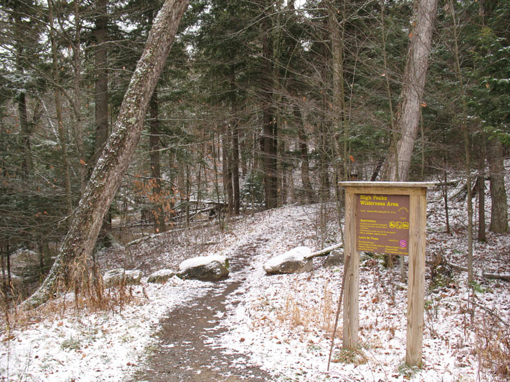
Parked at the Loj and started in on what might be my last hike for a while.   Mixed emotions when I got to Marcy Dam and remembered how it used to be a beautiful lake. 


Up the Van Hoevenberg highway to the 'unmarked' trail (complete with sign) to Tabletop.   Hop skip and a jump up, and I was there.    Great weather, little wind, bright sun.  Awesome views.


Back to Indian Falls right around noon for lunch, where again I had mixed emotions.  How many times had I drawn water there, or stopped and rested for lunch?
Back down the highway to the Dam for a long rest in the sun.   By now it was close to 50 degrees, and the trails over the last few days had turned into swamps in the afternoon sun, so the boots were soaked.  Took about an hour rest including a nap on the old dam, while my feet dried.   Sadly saddled up, and took a slow stroll back to the car, right as the temps really started to sink.

A hiker told me "tonight the temperatures are really going to drop" - no way I was camping in the cold again, so I hit the hostel in Keene Valley.   At this time of year it was empty, but they also hadn't done laundry, and the beds weren't made.   Weak, for $25, if you ask me.   At night, and on Monday nights especially, the town of Keene Valley essentially closes, so it was a quiet dinner of mac and cheese in the hostel.
Up at 6, on the road by 6:30, I got to the Chapel Pond trailhead for Giant at about 7.

Climbing Giant is like doing a 3 mile stairmaster, it's 3 miles and 3000 feet up.   That qualifies as 'steep' in my book.

Here's the Washbowl, frozen.  Up, up, more up, some great exposed ledges where the sun was melting the ice, and up some more to the junction.   A sharp right, and you head down a goat path towards Rocky Peak Ridge.   Took a serious wipeout on the way down, as the spikes failed me, and I went head over heels and crashed at the bottom of a rock face.   Ouch.   Pretty icicles though.

Through a nice col and a short climb up, and I hit the summit.   Done!   After 24 years, I'd hit all the High Peaks.   Beautiful weather, 45-50, not a breath of wind, no clouds.


This is why I saved this for last.  This exact scenario.  The view of everything.

On the way down, again skipping Giant (having done it), I took a page from Frost and from Baggins, and took the Roaring Brook Trail down towards St. Huberts.   Much easier, and beautiful hiking through immense pines.   Highly recommended over the Zander trail.   Got to the parking area near St. Huberts at around 3.   5 minutes and 9 cars later, my hiker trash karma kicked in, and I got a hitch back to my car, and then signed out.   At this point, so tired, so hungry.  And by now the sun had dipped behind the peaks, and it was FREEZING.  I had 1 more thing to do on the way to Keene Valley for dinner; there's a huge waterfall on the road near St. Huberts, but the sun almost never hits it - that is, unless it's late afternoon.   Perfect timing!

Boy the Adirondacks are beautiful.


    Upon the hearth the fire is red,
    Beneath the roof there is a bed;
    But not yet weary are our feet,
    Still round the corner we may meet
    A sudden tree or standing stone
    That none have seen but we alone.

--Bilbo Baggins


Fall and late Fall hiking are now my favorite time to be up there - despite the cold, you have the trails to yourself, there's no bugs, and if you catch the weather right, there's nothing better.

It's been amazing, boiling water at Lake Colden back when you could have fires there, climbing the Trapdike, doing the Dix Slide as my first trailless peak, finding out after I did it that there was a thing called The Great Range, watching sports and arguing politics with people in the Ausable Inn, and having summit after summit to myself over the years.  A great adventure.


Sunday, October 25, 2015

American Kleptocracy


Q: What happens when the government sells a resource cheaply, paying even for its transportation, to someone who has connections with the Department of the Interior?

A: 1794 federally protected wild horses get shipped to Mexico and eaten.

I've realized that this is an excellent metaphor for 21st century America.   Or a banana republic.   Or something out of Book 3 of Atlas Shrugged.
  • According to the allegations and news reports, Mr. Davis also had farming and trucking connections with former Secretary of the Interior Ken Salazar. 
  • Mr. Davis admitted that most of the horses that he purchased through the BLM went to slaughter. 
  • The agency also did not stop selling horses to Mr. Davis after receiving reports that he was sending the horses to slaughter. 
  • The OIG declined to investigate Mr. Davis‘ ties to Mr. Salazar. 
  • The investigation was referred to the U.S. Attorney’s Office for the District of Colorado as well as the State of Colorado Conejos County District Attorney’s Office, which declined civil and criminal prosecution (emphasis mine), according to the report. 

So who gets fired here, and who goes to jail?   Nobody, unless people are prepared to fight back.


Link here:
http://www.washingtontimes.com/news/2015/oct/24/blm-illegally-sold-thousands-wild-horses-slaughter/

Some more links about wild horse management.   Arguably they're invasive, and arguably burros are more so.   A certain amount of management is needed, but simply handing over 100s of thousands of dollars to a rancher is not "management".

Ridgecrest Regional Wild Horse & Burro Corrals 
Burros Inadvertently Save Life Of Hiker Lost In Death Valley National Park

Photo at top taken from the Sierra Institute's blog.   Note that I have no relation to them, and based on their blog, would never.  Hint: you don't take wild watercress from a spring in a desert - the wild horses and other animals you rhapsodize about are depending on it.

Friday, October 23, 2015

Walk in the Woods - and bring your flak jacket

It was a beautiful day, so I did some tramping in the uplands behind the property.   It's old farmland, now regrown, and logged for hardwoods about 25 years ago.   Great old stone walls, some interesting ruts and leftover trees from the logging operations, and some trails - some manmade, some machinemade, and some game trails.
Nice, right?

I kept walking, encountering a few beer cans along the way, and then this:


Kind of a buzzkill.
Folks, clean up after yourself, the next guy deserves the same experience you do.


Thursday, October 1, 2015

Hurricane!

Getting ready for Joaquin here on the farm.
  • Candles
  • Full tank of diesel in the car
  • Beer
  • Extra hay for the goats
  • Propane for the genny (more on that!)
  • Charging the phones and tablets


We have a good 6kW propane powered generator.   It's your standard Chinese clone, but it does put out 220, so I've piped it into the house and we have all the basics covered - heat (if needed), hot water, well, sewer pump, fridge.   If we do lose power I estimate about 24 hours continuously at 1/2 load given our propane supply.   Next year I'll move the circuit to the top of the panel, and we'll have everything powered.

What I discovered today is that some sort of insect decided to nest in the tube connecting the gas fitting to the carb.   Of course that was AFTER I pulled the plug twice, tested for spark, went and got a battery so I could use electric start... nothing, except a bunch of goop in the fuel line.

Disassembled the fuel line, ran a rat-tail file down it a few times to clean out the crud, and shazam, 6kW of sweet, sweet power.

Moral: if you keep your generator outside, plug up all the holes.

The animals will all be inside - the stall doors bolt, and I'm tying the main doors closed to prevent them acting like a sail.   The chickens should be fine, it's not cold enough yet for the wind to be a factor inside the barn.