Showing posts with label #LeaveNoTrace. Show all posts

Tuesday, September 13, 2016

Score one for the polar bears

(stock photo)


I have heard that polar bears are one of the few predators that will actively stalk humans.

http://www.adn.com/nation-world/2016/09/13/polar-bears-besiege-russian-scientists-at-a-remote-arctic-post/

Basically, mature and immature bears are patrolling around the base, and one large female is literally camped out on or under their building, waiting for them.   They've run out of flares to scare them off, and lost a sled/guard dog (poor thing) as well.

Bet on the bears - they were there first.

It's not unusual for polar bears to approach human outposts in the Arctic, where waste is often difficult to dispose of and attracts carnivorous predators. The phenomenon has intensified, though, due to climate change.

Arguably this is related to climate change - but arguably, hairless apes wandering the Arctic wilderness are much tastier and easier to kill and eat than seals, especially when the sea ice hasn't formed up yet.


Composting Privvies - how do they work?

During my summer as a Maine Appalachian Trail caretaker, I was "privileged" to take part in an event called "a mixer".   All 4 caretakers, plus some MATC volunteers, converged on the Horns Pond shelter area for a mid-year roundtable summit, a bit of a swim, and some hard, disgusting labor.

Horns Pond is high up on the Bigelow Range, and the thin alpine soil offer the traditional outhouse/privy dynamic; the waste won't decompose due to the lower temperatures and lack of organic matter.   So, the MATC has two composing privvies.

These do not compost themselves.  This is a thoroughly disgusting process.

In early summer, the caretakers and volunteers backpack many 40-50 lb. bags of mulch up the famed Firewarden's Trail, aka the MATC Stairmaster.

There are two privvies, each set high up on the edge of a hill and over a very large galvanized tub.  The entire area behind the privvies is roped off with biohazard signs, and it's on the downhill lie from the pond and spring which serve as the water sources.  The "droppings" fall down into the tubs.   Here's where its important not to throw trash into the privvies.   When full, volunteers don goggles, aprons, thick gloves, masks, and slather Vicks Vapo-Rub under their noses for the smell, and shovel forkfulls of mulch into the "droppings", at the same time picking out the Coke cans, wine bottles, flashlights and tampons from the more biodegradable stuff.   These are all bagged in multiple layers of plastic for pack-out.   Once there's a good amount of neutral carbon-based mulch/chips turned into the droppings, they're emptied out into covered compost bins.

At this point the volunteers are pretty much done.  Throughout the process, people manning water bottles are providing drinks so that no one touches their water bottles.  The workers frequently swap rubber gloves as the fingertips literally fill and overflow with liquid sweat.  Everyone washes their boots in bleach, and changes clothes - if you do all this in full sun you end up soaked to the skin, as everything you wear is impervious.   Fortunately, the Horns Pond is nearby, and a nice chilly 50 degrees or so.

The full-time caretakers then monitor the temperature of the compost piles, ensuring that they heat up enough to kill off all the bad bacteria, turning and managing as needed.   Once this happens for enough time, the now-composted mixture is spread out on screens to dry.    As it dries, the newly formed 'soil' falls from the chips, and once dry, the chips are further rakes to further separate the new soil from the chips; the chips are used again.   The soil is then manually dispersed throughout the area.

Next time you're up near treeline and there's a privy, give silent (or vocal!) thanks to the caretakers who quite literally, shovel your shit.

Here's a video from 2014, MATC is now using a rototiller (who packed THAT up the mountain?) to do the mixing.  Not sure I entirely support the mechanized, and LOUD equipment, but it probably does a more thorough job.


Friday, September 9, 2016

Trip Report - VT 4000 footers

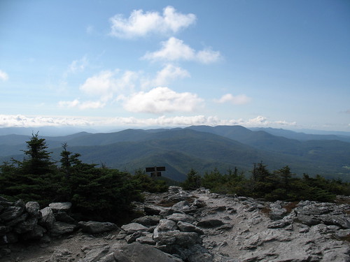
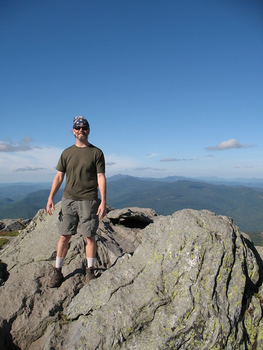
I spent 3 days in Vermont, bagging the 4 remaining 4000 footers (I did Pico/Killington years ago).

New gear / new hiking methods tried this trip:

  • Coolmax socks + coolmax/silk liners - giving this a try since I still get these weird blisters on the outside of my heels
  • Skipping breakfast and eating on the trail - you dont eat as soon as you wake up at home, why do it here?
  • No candy/junk - sticking to pretzels and trailmix
  • No coffee in the morning - the fresh air is all you need, plus it makes you poop


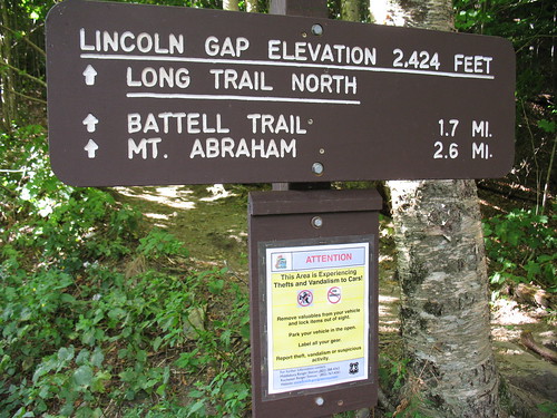
I first made my way up to the Lincoln Gap trailhead, where even the torquey TDI I drive had trouble on the 24% grade and the tight turns; I had to drop to 2nd gear to make it.   The Lincoln Gap road is the steepest paved road in America.   Of course some guys make a sport out of it - http://mountainpeakfitness.com/blog/2009-vt-6-gaps-ride !

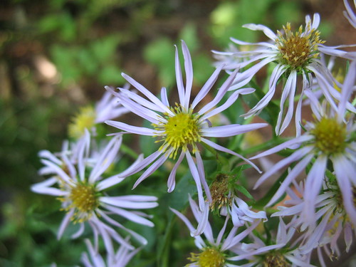
The trail is no cakewalk either.  1.8 miles to the shelter at around 2900 feet, with most of the gain coming in the middle third.   Still, a nice walk through hardwoods most of the way, I saw a cool bright green caterpillar (I think Orthosia hibisci), and a lot of mountain aster.


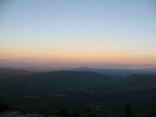
I stayed at the shelter, the Caretaker was off, probably recovering from a busy Labor Day weekend.  Two section hikers rolled in around 5:30, but pushed on, to bootleg camp on one of the ski slopes.  Up around dawn, I jumped on the trail and hit the summit a few minutes after sunrise.  In an area as hilly as the Green Mountains, sunrise comes to different places at much different times.


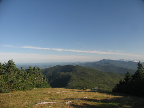
After this, I started the ridgewalk through some ski areas and a couple of tiny cols to make it over to Ellen.


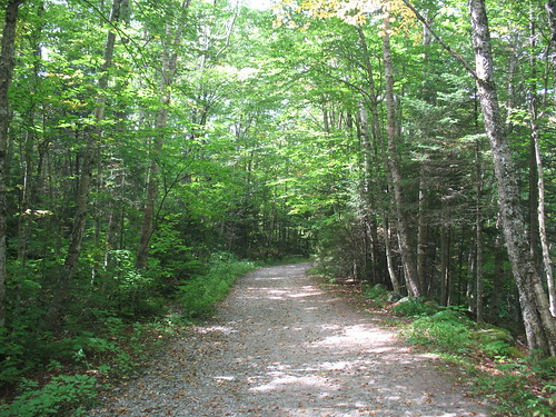
The trails in VT are great - not so steep like Maine, but not so blown-out as the ones in NH or NY.  I think it's a combination of less traffic (since the mtns aren't so sexy and high), and good trail maintainers.  Very enjoyable to walk on, some places even have leaf-litter covering the trails.  Contrast that to the High Peaks region where there are beach-ball sized boulders in the trail (Looking your way, Van Hoevenburg!).

Packed back along the ridge and down to the car, the nice thing about hiking early is that the sun is low enough that when you retrace your steps, the trail has a totally different aspect.
Wound my way down the cowpaths to Bristol for lunch, then drove up to the Huntington side of Camel's Hump.  After all, I'd done 12 miles with full pack, I might as well knock off a few more!   After collecting my thoughts I opted to do it with a daypack and come back down - the camping on Camel's Hump is WAY off ridge in either direction (E or S), and I just couldn't make myself lose all that hard-earned elevation.

Camel's Hump was hard, I guess because I started off already tired, but it was just damn steep (2400 feet in 2.4 miles).  Still, terrific trail conditions made it a lot better.   On the summit I was besieged by flying ants - apparently they ride the thermals up the hill to mate on the summit.   The summit steward(ess?) was awesome.


Once I got back down, I shared a beer and war stories with a fellow ADK46er, then drove north to Underhill State Park, where I camped for $20.  Great place, super friendly Ranger, very knowledgeable about the trails.  They mandate leashed dogs and were SO into Leave No Trace that they told people to pack out their own poop.  Not from the park of course (they had portapotties) but from the trail.

Great trail map from the State of Vermont:

Next morning on the way up Mansfield started easily enough.


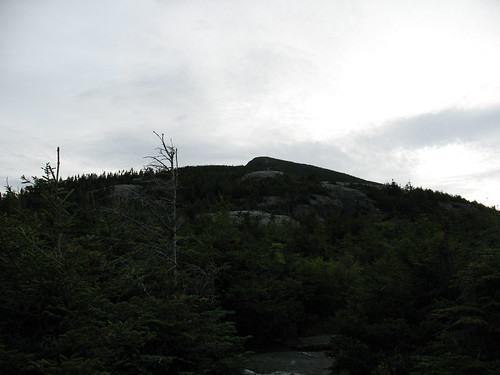
Then things got real on the Maple Ridge Trail up to the Forehead, topo map shows about 1500' in just over a mile.


Getting up to the Forehead, there was real weather rolling in from the East.   The ridgewalk became a subtle race against time as I could feel the normal thermals kicking up.


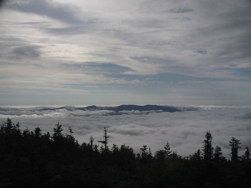
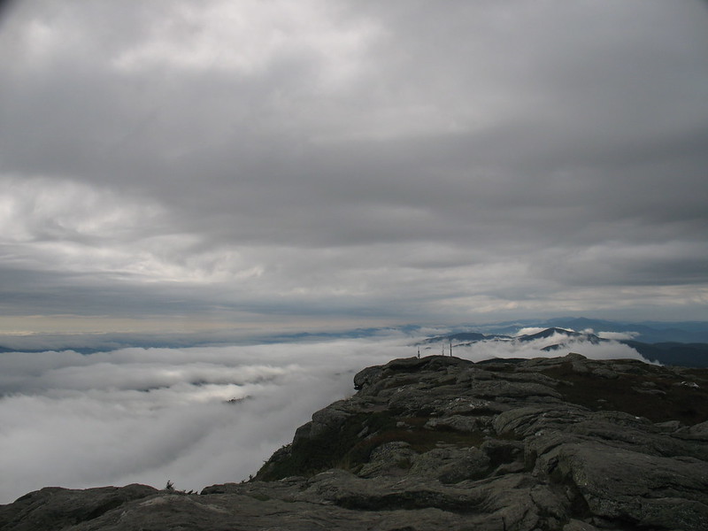
After a roadwalk past the visitor center area and gigantic radio antennae, I hit the Chin, completing my 4000 foot peakbags of VT.  Looking S, I could see the weather really coming in now.   What the still pic doesn't show is the "flow" of the clouds up and to the west (to the right):


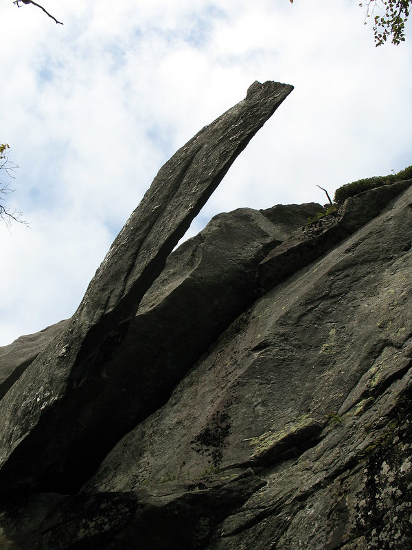
I hung out with the Summit Steward for a while, once again a great experience, the GMC knows their stuff.  Over the time I was there she went from wearing a Tshirt and shorts to pants, a long sleeve shirt, down jacket, hat, and scarf.  Finally, I was too freezing to stay so I headed down the Sunset Ridge Trail.   On the way there's a side trip to "Cantilever Rock" which is exactly that.


The picture doesn't really do it justice.  There's a nice flat lawn under it, a good place to take a break for lunch (tortilla and cheese).

A mile or so later, it was back on the Park road and the car.


I'm definitely heading back to VT for some of the other peaks, the people were great, the trails were great, and VT is a beautiful drive.

Monday, August 8, 2016

2002 Caretaker season logs - Piazza Rock, Maine


I found my old logbook from when I was a caretaker at the Piazza Rock shelter area on the Appalachian Trail in Maine.  What a terrific experience, it really opened my eyes to Leave No Trace as a philosophy, and the overall effect that small impacts have when multiplied by hundreds.  I spoke to hundreds of people that summer, and spent a lot of time on Saddleback mountain as a summit steward, keeping people off the alpine terrain and helping preserve the blueberries and mountain cranberry for the bears.  I count "section" hikers rarely, only if they told me they were section-hiking, else, everyone was a dayhiker.


I've posted the daily hiker counts in my Google Docs, the link is here:
https://docs.google.com/spreadsheets/d/1F7LPAtiOpAIcW-kr8OWH2VubHvHvb14SkHU0xe5Whro/edit?usp=sharing

Gaps exist due to time off.   I was 10 days on, 4 off.
 
As expected, a big surge of northbound thruhikers came in September, racing the closure of Katahdin.  What I had forgotten about, was a strange trickle of SOUTHbound hikers in September as well.

This tells me that if I want to climb Saddleback with minimal traffic, pick some time in early August - for a year which had the same kind of Spring as 2002!   Some years the Mountain is open early, som late.

What's funny are the notes I made, apart from weather observations and trail conditions from my ridgeruns - I had some unkind things to say about a lot of the northbounders I met, and based on my own experiences hiking, I want to say its for 2 reasons: they're very proud of themselves, and assume you know nothing about what they've experienced, and secondly, they've just made it through the Whites and the over-sanitized, restrictive rules of the AMC.   In Maine there's no fees, and the caretakers have a much different role.

My biggest official duties included cleaning graffiti from the summit of Saddleback (yep, really), chasing an ATV rider off the Trail corridor, and getting Colby college in trouble for camping above treeline.

The next time you're at a backcountry site with a privy, or there's a bog bridge, or stone stairs, or a piped spring, give a little thought to the folks who invested their time.   By providing a permanent, convenient place to camp, it focuses the impact on 1 area instead of spreading it out along the entire trail like a strip mall.

Sunday, July 24, 2016

Hiking closer to home: Foster Land Trust Hayfield property

I took a few hours the other evening to do a stroll through some tame woods in Foster, RI.   The property was left to the Town Land Trust some years ago, and has recently had its old roads and game trails blazed.
The map is here.


No major elevations, just a stroll through some woods that recently were farm - you can still see stone walls, a few cellar holes, and a mill site, straddling the sleepy little Poneganset River.


Once I got to the river, I left the "official" trail and kept to a less worn trail (probably the old road) along the river.  Across the river were several fords; the land on the other side is RI DEM land, probably used exclusively by hunters.


Hearing thunder in the distance, on a hot sticky evening, I started trying to make my way back.  Minus the map, I dead-reckoned my way to a path that led to a hayfield, where I made my way along the edge.

The storm was moving in, so I picked up the pace, coming eventually to Winsor Rd, a twisty country lane in Foster, and back to the car.


I'll head back sometime to complete the trails, and definitely hit the place in the winter for snowshoeing.


Saturday, January 30, 2016

Barrel stove kit installed - syrup season here I come

Every year I gobble up a few tanks of propane making syrup from the maples on my property.  Because I have mostly red and swamp maple, whose sugar content is in the .5-1.5 percent range, I have to boil a lot of sap.

Side note: I've planted sugar maple saplings that I bought from the Arbor Day people, but that's 8-10 years out.

Given the massive amounts of wood, brush, and a stand of girdled trees that I've slowly been harvesting, I have "free" fuel.   Boiling my own sap with my own wood as fuel using recycled parts gives me "free" maple syrup, manages brush on my property, is carbon-neutral, and is a great hobby.

I purchased the Vogelzang barrel stove kit from Northern Tool, and today took advantage of the 40 degree (F) weather and installed it.   Total time about 2 hours, and I only cut myself on the sharp metal once.   The kit has the cast iron feet, front door and an adapter/damper for a 6" pipe.
Tools you will need:
Drill with a small and a 5/16" bit
Jigsaw/Sawzall with a metal cutting blade (or 2)
Magic marker for marking your cuts
Beefy phillips-head screwdriver
Cleverness at filling in the blanks on the instructions

Total cost: free barrel (but look on Craigslist, $25-40 is the norm), $51 for kit incl. shipping, 2 bags of play sand and 2 lengths of 6" pipe, total $80.

Instructions were good, not even chinglish, but left many small details out.   If you've built things and are handy this is not a problem.   If you are looking for IKEA-like detail, seek help or look elsewhere.

Ear plugs are a must.   One thing I found is that unless you punch all the holes first, they'll have a tendency to 'walk' while you're drilling, and nothing will line up.   What I did was get the parts on with 2 or 3 screws, then used the holes in the Vogelzang castings to line up the drill - everything went together perfectly.

Once assembled, I put a few inches of sand in the bottom and lit it up.   Worked like a charm, exactly as I had imagined it would.   At one point the surface temperature was 800 degrees (F).   It had a pretty funky paint smell for a bit.  I let it burn down, I'll scrape the charred paint off later, and maybe hit it with a can of stove paint.  Next step will be to attach a shelf to hold the pan of sap (stainless steel steam-table tray).   I can taste the syrup now.

Front attached:

Feet attached:

Chimney adapter attached

First firing (note the smoking paint)

Nice and warm!

Tuesday, January 26, 2016

Looking to improve your hiking performance? Drop some weight

Gear
Most people, even active people, could stand to lose a few pounds.   While there's a lot of time spent on gearmongering and swapping steel for titanium, let's look at what weighs what.  "A pound on the foot is like 5 on the back" they say.   What about "a pound off the belly is a pound off the back?"

Looking at my pack weight thread here and my Google docs spreadsheet for my base weight is just under 15 lbs.

Personally, I could lose 10 lbs.   That means I could add 10 lbs of food and water to my base weight, and do an overnight with essentially an empty pack.   That's huge!

Also, generally the process of losing weight is going to build up your strength, which means more miles, and more, BETTER miles.   You don't want to drag ass into camp at dusk, miserable and winded.   A light pack and fit legs are the best way to do this.  Spare energy and a good attitude go a long way towards making it easy to Leave No Trace.   You won't be tempted to take shortcuts, leave microtrash or food crumbs, if you've still got something left in the tank at the end of the day.

Water
I generally start off with a 70oz Platypus and whats left of breakfast in a Nalgene.   Combined that's about 5lbs of water.   Want to carry that for free?  Lose 5lbs - it's really not that hard.

This winter and spring the focus will be dropping weight, for higher performing summer hiking.

Thursday, December 17, 2015

One man's trash ... is another man's trash

Microtrash is always a big problem, and rare is the trip I take without coming home with a cargo-pants pocket full of it.  Common offenders are cigarette butts, corners of Clif/Snickers/Nature Valley bars, crumbs of those ubiquitous blue foam pads, and the occasional bandaid.  Note, I never pick up toilet paper, so ladies, please try and pee farther away than right next to the trail.

Macrotrash is a little more of an interesting dilemma.   You see either modern dumpsites at trailheads (tires, beer cans) or you find 'historic' items rusting away at an old cabin site, or the remains of a can dump at an old shelter.   Sometimes its piles of trash, and unsightly, or its in high traffic areas where it encourages more trash.   Here's a case where a very busy caretaker in the Maine Applachian Trail Club cleaned up a massive amount of really bad trash.   I helped carry down some big rusty iron bits on my way down the Firewarden's Trail (totally overwhelming my pack's suspension, but worth it).
http://www.matc.org/assets/Resolved-Refuse-Removal-ATJourneys-MarApr2014.pdf


I can live with some of it, things like this I found in the desert of southern California.   It adds a certain atmosphere, and has some historical value.   This area was actively mined for gold.


But what kills me is the modern "woodsman's" trash.  Plastic garbage bags left behind.   Propane cannisters.   Toilet paper.  5 gallon buckets of poop.   Benches, tables, chairs hacked together with local lumber and plywood.   When I was a caretaker on the AT in Maine, I once packed out nearly a full black trashbag, just from a single hike ~40 miles and hitting 3 shelters.  Unacceptable!

These are the things that say "This area is actively used.   It is not wild, whatever you thought you were going to see.   It's a campsite, a playground, a city park.   It's to be used and consumed, not preserved or saved for the next person.   We beat you to it, so suck it."

Monday, November 23, 2015

And then there were three

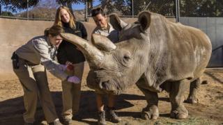
A northern white rhino has died in a zoo in the US, leaving 3 left in the world (in Kenya).


The remaining ones are locked away in a preserve, so that men with small penises will not kill them and consume their horns.

http://www.olpejetaconservancy.org/wildlife/rhinos/northern-white-rhinos/


How many is enough?    Consider supporting the Ol Pejeta Preserve.

Thursday, November 19, 2015

November hiking - Ampersand, Seymour, Tabletop and Rocky Peak Ridge

Hitting the summit of Rocky Peak Ridge on November 17, 2015, I finished all 46 of the Adirondack High Peaks.   24+ years in the making, done.   I can't believe it, but I'm already planning my next trip - a 5 day traverse of the whole High Peaks region, from Coreys to Elizabethtown.

I arrived at the Ampersand trail head at around noon on Saturday, and immediately was struck by the cold.  I brought both spikes and snowshoes, not knowing what to expect.  The first section of trail was easy, smooth sailing over the frozen mud.  And then the climb began.   I switched to spikes about halfway up.


The summit was brutal, I met a bunch of other hikers on the way who didn't go all the way up.  Wind and fog, rime ice everywhere.

Back down around 3, just enough time to head to the cafe in Lake Placid for a sandwich, then back to the trailhead to camp.   There's a supposedly pay campsite on the shore of Middle Saranac Lake, but it was off-season.  An easy .6 miles (wearing orange because it's hunting season, and I found a nice out-of-the-wind spot for the tent.   The wind off the lake was chilly, to say the least.


The next morning I drove through Coreys and parked.  Surprisingly, there were people there ahead of me.   The 5.4 miles into Ward Brook Leanto were a cakewalk - frozen trail, beautiful sun on the frozen trees, milder weather, no wind.  Really just perfect hiking.

Then the fun began, the 'trailless' climb up.   It was mostly obvious, I got turned around only twice.


The ice on the blown out rock slides was vicious, some places an inch thick.  Thank you Microspikes!

Back down, only wiping out once or twice, and back to the car by 4.   At this point I drove back through Lake Placid to the Ausable Inn in Keene Valley for a beer and some dinner.   Then on to Meadows Lane outside the Adirondak Loj, where I tented alone, and in the dark under headlamp.   It's free camping on DEC land, this time of year totally deserted.  Normally the sites are all taken, as you can't camp at the Loj.

Parked at the Loj and started in on what might be my last hike for a while.   Mixed emotions when I got to Marcy Dam and remembered how it used to be a beautiful lake. 


Up the Van Hoevenberg highway to the 'unmarked' trail (complete with sign) to Tabletop.   Hop skip and a jump up, and I was there.    Great weather, little wind, bright sun.  Awesome views.


Back to Indian Falls right around noon for lunch, where again I had mixed emotions.  How many times had I drawn water there, or stopped and rested for lunch?
Back down the highway to the Dam for a long rest in the sun.   By now it was close to 50 degrees, and the trails over the last few days had turned into swamps in the afternoon sun, so the boots were soaked.  Took about an hour rest including a nap on the old dam, while my feet dried.   Sadly saddled up, and took a slow stroll back to the car, right as the temps really started to sink.

A hiker told me "tonight the temperatures are really going to drop" - no way I was camping in the cold again, so I hit the hostel in Keene Valley.   At this time of year it was empty, but they also hadn't done laundry, and the beds weren't made.   Weak, for $25, if you ask me.   At night, and on Monday nights especially, the town of Keene Valley essentially closes, so it was a quiet dinner of mac and cheese in the hostel.
Up at 6, on the road by 6:30, I got to the Chapel Pond trailhead for Giant at about 7.

Climbing Giant is like doing a 3 mile stairmaster, it's 3 miles and 3000 feet up.   That qualifies as 'steep' in my book.

Here's the Washbowl, frozen.  Up, up, more up, some great exposed ledges where the sun was melting the ice, and up some more to the junction.   A sharp right, and you head down a goat path towards Rocky Peak Ridge.   Took a serious wipeout on the way down, as the spikes failed me, and I went head over heels and crashed at the bottom of a rock face.   Ouch.   Pretty icicles though.

Through a nice col and a short climb up, and I hit the summit.   Done!   After 24 years, I'd hit all the High Peaks.   Beautiful weather, 45-50, not a breath of wind, no clouds.


This is why I saved this for last.  This exact scenario.  The view of everything.

On the way down, again skipping Giant (having done it), I took a page from Frost and from Baggins, and took the Roaring Brook Trail down towards St. Huberts.   Much easier, and beautiful hiking through immense pines.   Highly recommended over the Zander trail.   Got to the parking area near St. Huberts at around 3.   5 minutes and 9 cars later, my hiker trash karma kicked in, and I got a hitch back to my car, and then signed out.   At this point, so tired, so hungry.  And by now the sun had dipped behind the peaks, and it was FREEZING.  I had 1 more thing to do on the way to Keene Valley for dinner; there's a huge waterfall on the road near St. Huberts, but the sun almost never hits it - that is, unless it's late afternoon.   Perfect timing!

Boy the Adirondacks are beautiful.


    Upon the hearth the fire is red,
    Beneath the roof there is a bed;
    But not yet weary are our feet,
    Still round the corner we may meet
    A sudden tree or standing stone
    That none have seen but we alone.

--Bilbo Baggins


Fall and late Fall hiking are now my favorite time to be up there - despite the cold, you have the trails to yourself, there's no bugs, and if you catch the weather right, there's nothing better.

It's been amazing, boiling water at Lake Colden back when you could have fires there, climbing the Trapdike, doing the Dix Slide as my first trailless peak, finding out after I did it that there was a thing called The Great Range, watching sports and arguing politics with people in the Ausable Inn, and having summit after summit to myself over the years.  A great adventure.


Friday, October 23, 2015

Walk in the Woods - and bring your flak jacket

It was a beautiful day, so I did some tramping in the uplands behind the property.   It's old farmland, now regrown, and logged for hardwoods about 25 years ago.   Great old stone walls, some interesting ruts and leftover trees from the logging operations, and some trails - some manmade, some machinemade, and some game trails.
Nice, right?

I kept walking, encountering a few beer cans along the way, and then this:


Kind of a buzzkill.
Folks, clean up after yourself, the next guy deserves the same experience you do.