Showing posts with label #TravelandCamponDurableSurfaces. Show all posts

Monday, August 8, 2016

2002 Caretaker season logs - Piazza Rock, Maine


I found my old logbook from when I was a caretaker at the Piazza Rock shelter area on the Appalachian Trail in Maine.  What a terrific experience, it really opened my eyes to Leave No Trace as a philosophy, and the overall effect that small impacts have when multiplied by hundreds.  I spoke to hundreds of people that summer, and spent a lot of time on Saddleback mountain as a summit steward, keeping people off the alpine terrain and helping preserve the blueberries and mountain cranberry for the bears.  I count "section" hikers rarely, only if they told me they were section-hiking, else, everyone was a dayhiker.


I've posted the daily hiker counts in my Google Docs, the link is here:
https://docs.google.com/spreadsheets/d/1F7LPAtiOpAIcW-kr8OWH2VubHvHvb14SkHU0xe5Whro/edit?usp=sharing

Gaps exist due to time off.   I was 10 days on, 4 off.
 
As expected, a big surge of northbound thruhikers came in September, racing the closure of Katahdin.  What I had forgotten about, was a strange trickle of SOUTHbound hikers in September as well.

This tells me that if I want to climb Saddleback with minimal traffic, pick some time in early August - for a year which had the same kind of Spring as 2002!   Some years the Mountain is open early, som late.

What's funny are the notes I made, apart from weather observations and trail conditions from my ridgeruns - I had some unkind things to say about a lot of the northbounders I met, and based on my own experiences hiking, I want to say its for 2 reasons: they're very proud of themselves, and assume you know nothing about what they've experienced, and secondly, they've just made it through the Whites and the over-sanitized, restrictive rules of the AMC.   In Maine there's no fees, and the caretakers have a much different role.

My biggest official duties included cleaning graffiti from the summit of Saddleback (yep, really), chasing an ATV rider off the Trail corridor, and getting Colby college in trouble for camping above treeline.

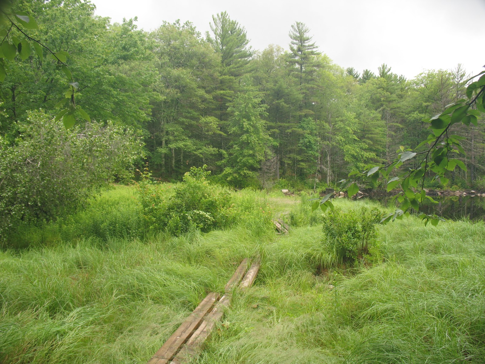
The next time you're at a backcountry site with a privy, or there's a bog bridge, or stone stairs, or a piped spring, give a little thought to the folks who invested their time.   By providing a permanent, convenient place to camp, it focuses the impact on 1 area instead of spreading it out along the entire trail like a strip mall.

Sunday, July 24, 2016

Hiking closer to home: Foster Land Trust Hayfield property

I took a few hours the other evening to do a stroll through some tame woods in Foster, RI.   The property was left to the Town Land Trust some years ago, and has recently had its old roads and game trails blazed.
The map is here.


No major elevations, just a stroll through some woods that recently were farm - you can still see stone walls, a few cellar holes, and a mill site, straddling the sleepy little Poneganset River.


Once I got to the river, I left the "official" trail and kept to a less worn trail (probably the old road) along the river.  Across the river were several fords; the land on the other side is RI DEM land, probably used exclusively by hunters.


Hearing thunder in the distance, on a hot sticky evening, I started trying to make my way back.  Minus the map, I dead-reckoned my way to a path that led to a hayfield, where I made my way along the edge.

The storm was moving in, so I picked up the pace, coming eventually to Winsor Rd, a twisty country lane in Foster, and back to the car.


I'll head back sometime to complete the trails, and definitely hit the place in the winter for snowshoeing.


Friday, July 8, 2016

Trip Report: RI North South Trail

Over the holiday weekend I thru-hiked the Rhode Island North/South Trail, a 78 mile path from the Atlantic Ocean to the RI/MA border in Burrillville, RI.

Total time: approx 3.5 days
Total mileage: approx 80 miles including travel from the trailhead

If you JUST want pictures, the full album is here (on my personal server, ignore the self-signed cert warning):
https://vmeps.schernau.com/photos/main.php?g2_itemId=1851


Overall, a great time, I saw a lot of wildlife, encountered some nice people, saw some interesting relics of settlement, and got to really see the terrain and weather changes as you move away from the coast.   The biggest takeaway is that this is not a hike, it's a walk.   I could count the # of times I got out of breath due to terrain with one hand.  Walking this long on this kind of low elevation gain trails is more an exercise in blister and boot management, than it is a test of endurance.   Contrast this with a trip in the mountains of Maine or New York, where you're more often than not limited by your lungs.  At least I am, your mileage may vary.

There's a lot of roadwalking, I mean a lot, one stretch is over 11 miles.  If this is not your thing, then skip the trip.

If you can, find the Cliff Vanover book, available from Great Swamp Press.  You can do it without the book, or even without maps, but there's neat info in there, and has a good section for off-trail resources such as local campgrounds.  The signage is aggressive, overly so.   Instead of the 'double blaze' at trail forks, it's everywhere you make a turn, even if there's nowhere else to go.   It's often accompanied by a plastic N/S Trail sign, with arrows drawn on in marker.  You CANNOT get lost.

There's also no legal on-or-near-trail camping, except in the northern section where it goes right through a state campground.   Bootleg camping is not permitted.   I will leave this as an exercise to the reader.   As always, follow LNT principles.

Water can be a challenge.  I carried at most a gallon, and only dipped down into my emergency quart once.   There's only a few places where you can get free clean water, so carry at least something like iodine, and consider a water filter, as the water you find might be contaminated with suburban or rural runoff - oil, fertilizer, etc.

Day 1: Charlestown RI, the Blue Shutters Town Beach
I got dropped off at 6:30 at the beach parking lot.   The first few miles were a roadwalk through a nice neighborhood, complete with joggers and dogwalkers.   After a mile or two, my feet started to feel the pain of walking on asphalt.

The trail quickly moves into woods roads and state hunting/management areas, a mix of dirt road and trail.   At one point you pass through a sod farm.   The eerily flat/smooth soil and stench of nitrogen was unpleasant.


There's a nice pond/beach area at mile 11.93.

Day 1 ends with a long roadwalk, then a walk along the old highway, the New London Turnpike, now a dirt road under power lines, littered with trash like broken TVs.   From here the roar of I-95 is omnipresent.   You cross under it later, and for a while walk along it - at least its visible through some trees.


Shortly after this you enter the Arcadia Management area.
It was here I encountered trail magic!   A woman stopped her truck and gave me a fistful of "sweet fern", which when crushed and rubbed all over, repels mosquitoes and deerflies.

A note on bugs:
Deerflies, blackflies and mosquitoes are a constant challenge.   One thing I discovered is that by wearing a floppy straw hat that covers the ears, and good sunglasses, the deerflies cannot divebomb your ears, and the blackflies cannot fly into your eyes.   If you can steel yourself to hearing the deerflies endlessly circle, and the blackflies bouncing off your sunglass lenses, it's not too bad.

In the Arcadia Mgmt area, there's a beautiful pond/brook called Roaring Brook Pond.  This is at around mile 25.5.   One should always camp near a water source - but of course not too near!


Day 2:  Mostly Arcadia, then into Moosup Valley/Coventry/Foster
Arcadia is great, especially when there's not a lot of people.   Hiking through at 7am is a great time.   Hawks, deer, songbirds, and the bugs not too bad.
At Stepstone Falls I stopped and took a brief nap, and was amazingly recharged.   I think 10-15 minute naps are going to be my new thing.

Moving through and out of the area, I crossed through the old Escoheag Ski area.   There's some random machinery in the woods still, and here's the parking lot.


Then a long roadwalk, uphill.   But, after passing an area recently cleared to provide Cottontail habitat, I hit the halfway mark!

Through here, the gypsy moth caterpillar devastation is so great, it's winter.  Not only have they stripped the oaks, but the undergrowth/blueberry thickets as well.   Bears will go hungry, so people of western RI, lock up your trash extra tight.  I hate gypsy moths and tent caterpillars.


Coming out of here, some more walking and you cross the Moosup River on a high trestle bridge.   You're at about mile 40 here.  At this point the trail goes past a beautiful pond, Carbuncle Pond, where I took a nice long 2 hour break.   My feet were blistered heavily at this point, so I didn't swim, but I got all new water, and had a bit of a wash.

I live sort of near here, and at this point there's no state owned land for another 20 miles, so I pushed on, figuring I'd eat miles and walk as far as I could to split up the next 12 miles of roadwalk.  You pass through little hamlets like Rice City and Vaughn Hollow.
On the old Plainfield Pike (the other highway) I passed one of the old toll houses.  20 miles to Providence, if I wanted to walk there.


Trudging along (really trudging at this point, all roadwalks, 40+ miles in 2 days, just wanting to sit or sleep), I got to the historic village of Moosup Valley in Foster, where my ride awaited at mile 46.

Day 3:  Foster-Glocester (July 4)
More roadwalking, down 1 lane country roads and past farms.   You can tell its an election year.

At mile 53 you cross Interstate 6, the busiest road so far, but early morning it's not too bad.  At the Shady Acres restaurant I had a nice, shady break, complete with coffee, a muffin, and a tiny nap.   I got to watch a group of Revolutionary War re-enactors muster in the parking lot, then climb into a car and drive off somewhere.  A brief trip back into the woods by an old shingle mill, then its back onto the road for more miles.


Entering the Killingly Pond area, you cross into Connecticut briefly.   This park was awful, really beat up roads, nothing smooth, but nothing soft because its stripped to the rocks, and you walk through a "wonderful hemlock forest", which as everyone knows, is code for 'dark, mucky, and full of mosquitoes".

Emerging back onto the asphalt, I went through some rural neighborhoods until I got to the Oak Leaf Campground, at around mile 62.   At this point it was midday, and about 85 degrees, so I stopped at the camp store for some cold drinks.  An hour later, saddled back up and did the 4 mile trip through the Durfee Management area to the George Washington Management Area, at around mile 66.5.   Durfee was pretty bad, roads tough, muddy, and plagued by ATVs.

For $14 I got a campsite at the state campground at George Washington, and was then reminded of the perils of staying in a public campground on July 4.   Dogs, generators, and fireworks.   At this point I'd done 66 miles in 3 days, much of it on roads, and most of it in 80+ weather.  The blisters at this point were torn open and lets just say, painful.  

And then the rains came.   Fortunately I had some raingear, and had staked the tent well.   

Day 4: To the end

The rains lasted until around 9:30 on the morning of the 5th, at which point it started to get warm.   Dreading the combination of wet woods, hemlock groves, and 80 degree weather, I rebandaged my feet and saddled up.   Here the trail follows a set of other trails known as the Walkabout Trail, but thanks to the aggressive signage, you can't get lost.


Working through the Management Area, it started to feel a little more like hiking.  Some ups and downs, nothing major, but the terrain started to lose its sameness, and being off even a dirt road gave it a more rural feel.   The start and the end of the trail are definitely the best parts for that.


Coming out into another neighborhood and passing some powerlines, you come to the final road crossing, where you move into the Buck Hill Management Area.   This is the Maine of the trail - totally away from anything, steeper ups and downs, blueberry thickets, and bugs.

I got to a trail register, and knew I was nearly there.   Feet sore, hot, tired, I was instantly invigorated and pushed on.

Through more wet blueberry thickets (these untouched by caterpillars), I stumbled out onto a dirt road, and reached the end.


A two mile hike through the Management Area, past a neat wildlife marsh complete with beavers, and my ride awaited.

Final thoughts:

Would I do it again?   Probably not, certainly not the same way.   I might try to combine it with a bike ride.   The roadwalking really wasn't fun.   Not because of cars, or annoying dogs, simply because of the physical impact of walking on asphalt.

Glad I did it?  Absolutely.  I've wanted to do this since the trail was built.

Rhode Island is really a neat state.   Within 40 miles you have a capitol city full of universities, you have both the bay and ocean beaches, and you have some beautiful wooded areas to explore.  No real climbs, no summits, no real views except for in rare instances, but it's like going back in time.   At one point almost all of RI was cleared farmlands, now you see the cellar holes, the stone walls, and newer things like ski resorts that closed 40 years ago.   You get to walk through old hamlets like "Wood River Junction" and "Vaughn Hollow" where probably everyone knows everyone.  There's wildlife everywhere.   Best of all, if you're from here, getting to any of these trails or getting a ride back is an easy <1 hour drive.  Get out and go hiking!

Monday, December 7, 2015

Leaving no trace in paradise

Digging through some old hiking photos from Hawaii, I was struck how similar the trail is to New England, despite having probably 1/100 of the traffic.   That volcanic soil just can't take the abuse, similar to the thin layer of soil on top of the mineral soils covering the mountains of the Northeast.  Just like how in alpine zones like Marcy, Washington, Saddleback and Katahdin one step off the trail does irreparable damage, the terrain on relatively 'new' land like the Hawaiian islands is fragile.

First you have jackasses like this.   Despite a marked trail, an easy trail that doesn't need poles, a sign to stay on the trail, these  two decided to take a break off the trail to adjust.   The terrain seems hardly fragile, but it's the sense of wildness you're looking to preserve.   If you end up with footbeds all over the lava, then its not a cool dormant crater anymore, its a city park.


On Kauai, in the Waimea Canyon park, there's a long trail that runs through jungle then along the coast.    Here you have a hip-deep trail, and a "bonus" trail along the side, probably created by sneaker-wearing hikers in the wet season.   If you #PlanAheadAndPrepare you have the right shoes.


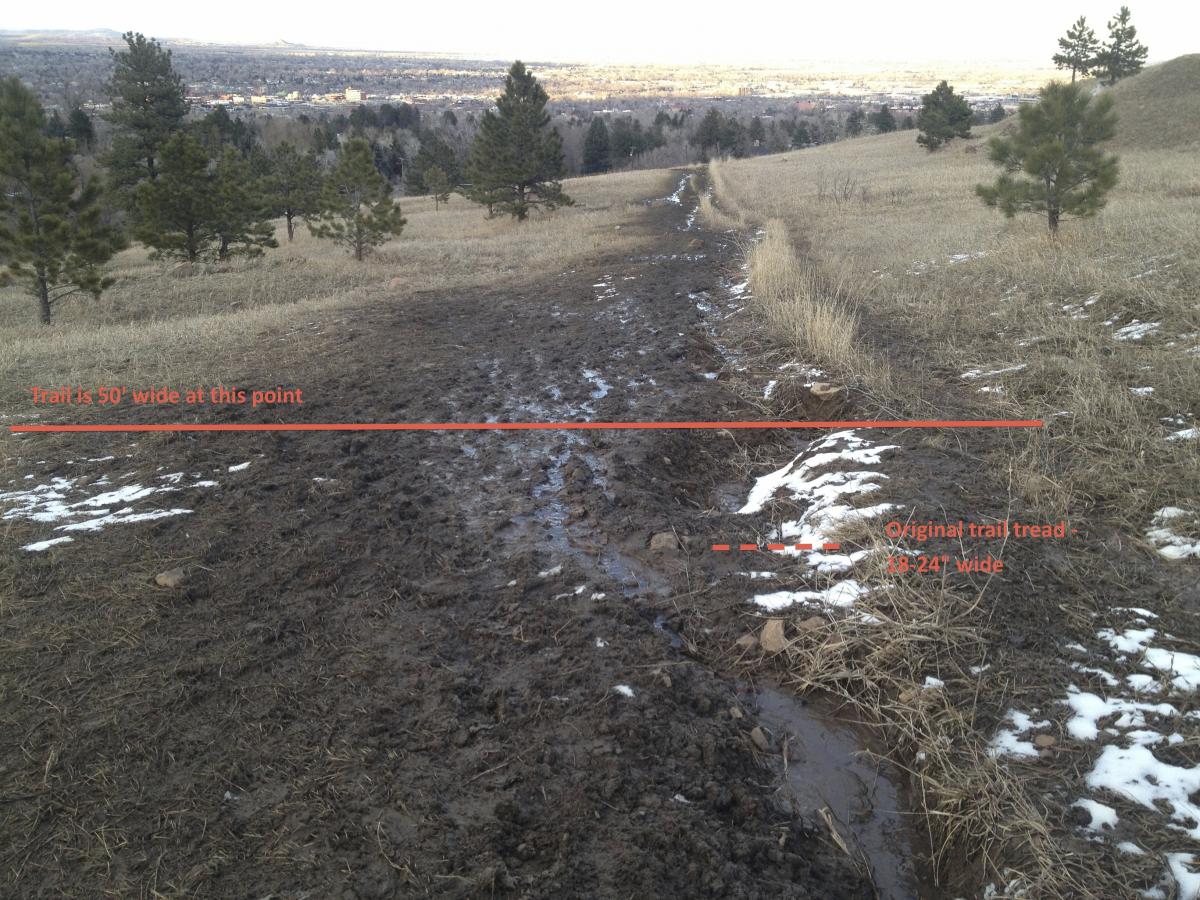
When the trail is eroded like this, you want to stay on it - and you can see the subtle psychological pressure to keep away from the edge; the soil is getting compacted as the trail erodes.


These are the only legitimate ones allowed to go off-trail.   Partially because they live here, partially because they have four wheel drive.


It's important to leave the land in the condition you've found it, as you owe it to the guy behind you.   Let him have his experience, just as you had yours, and perhaps next time, someone will leave something for you.

Thursday, July 9, 2015

Adirondack Trip - Street, Nye, Allen and Cliff


This past weekend I knocked off 4 more of the High Peaks, all "trailless" - which means no signs, and no maintenance, but hardly a bushwhack.

Pics are here:
https://vmeps.schernau.com/photos/main.php?g2_itemId=1545

I started parked at South Meadows about a mile from the Adirondak Loj, hiked the road, then climbed up Street & Nye.   Generally an uninspiring, easy hike, there was an interesting ford required due to high water and recent rain.   Fords are always fun, especially ones where the blackflies are not devouring you as you precariously cross.   Minimal view, and plenty of insects once you stopped moving.   Met a few people.  The nice thing about using a small daypack is that you can travel fast and light, I actually snuck up on someone sitting eating lunch I was moving so smoothly.

Got back to the car by about 6, decided not to camp as it looked wet.   Drove to the Hostel in Keene Valley where I've stayed many times, and crashed late, after staying up talking to some rock climbers.

Next day drove way around to the Works in Newcomb, parked the car, and began the start of the 16 mile day including Allen, and ending at the Flowed Lands.   Several significant fords, and the most schizophrenic trail I've hiked - alternating sections of smooth old woods road, and 20' wide muddy quagmires.  Once you hit the slide, you're walking up bare rock, or better, bare rock with water flowing over it.  I wiped out significantly only once.   Minimal view, and horrific bugs at the top.

Back down and across another ford, and a long gradual slog uphill to the Flowed Lands, where the last and biggest ford awaited.

Camped near the Flowed Lands Lean-To, then early in the morning daypacked up Opalescent Brook to Cliff - another muddy, trailless mess.   Socked in completely with clouds and fog, it was a fun climb with some interesting rock scrambles.

Back down the old closed trail and another ford down Calamity Brook, did some skinny-dipping and de-funkifying, and got back to the car in time to drive to Keene Valley for dinner.

5 stars, would do again (maybe sometime)


Saturday, July 4, 2015

Weighed in the scales and (not?) found wanting

Heading up to the Adirondacks again, and I thought I'd weigh in, literally.   We bought a kitchen scale recently to help with big batches of canning, and it has a good capacity and resolution.   And its a quiet, hazy afternoon, nothing better than getting your gear sorted.


(Jake the Wonder Dog assisting)


Short version: Base weight = just under 14 lbs, although I didn't include water carrying - my 70oz camelback, my 1L Platypus and my 1L nalgene.   Google tells me that these weigh approx 5oz, 1oz and 6oz respectively. Adding this all in pushes it up close to 14lbs.  Factoring in a few odds and ends and my car keys & wallet, lets call it 15lbs.   Not bad.   It doesn't include clothes, but the only things generally that sit in the pack are a pair of extra socks, a knit hat, and a rain jacket.  If you don't wear it daily, it's a waste.

I've included a link to my pack list on a Google Spreadsheet here:
https://docs.google.com/spreadsheets/d/1oCVW3B8WjOjlplQMycklFiQ-qJs_H5toccit7ec3vck/edit?usp=sharing

This includes both my stove and my bear cannister @ 2lbs11oz (heaviest thing I have).   When packing up in the Adirondacks, the Eastern High Peaks zone requires bear cannisters for overnight camping, so I leave the stove at home.   The other option you have is only do day-hikes, but there's something magical waking up in the mountains in the middle of the night, or being able to hit the trail at 5am.

Keeping your pack weight down is an important part of being a responsible hiker - you're less likely to get tired, less likely to 'cheat' and grab at trees or widen muddy areas, less likely to get hurt and need rescue, and you're bringing less trash which could be left behind.   Slipping quietly along the trail and creating a minimalist campsite (small tent, muted colors, little or no cooking) means that you're not affecting the animals or others seeking their own experience.

Tuesday, May 19, 2015

Adirondack Trip May 2015


4 down, 7 out of 46 to go.

I got up to Keene Valley at about 10am on Saturday, rented one of those bear cannisters at The Mountaineer, then drove back S to the Elk Lake Preserve to hike Macomb.   A nice flat trail, wet, and then the slide started.   It wasn't a pure rock slide, it was all sand and football sized chunks of rock.   Only twisted the ankle once, but fell multiple times... only bled twice.

The trip back to the car was uneventful, and on the drive back to KV, I saw a moose!   First time seeing one in the Adirondacks, believe it or not.

Saturday night I was reacquainted with the joys of hostel living, as 4 French Canadians rolled in at about 1130, and THEN thought it would be a good idea to look for where they kept their clothes, toothbrushes, etc.

Woke Sunday at 5, on the trail by 6.   Did:
  • Roostercomb
  • Hedgehog
  • Lower Wolfjaw
  • Upper Wolfjaw
  • Armstrong
  • Gothics
  • Pyramid
  • Sawteeth
  • Indian Head
Then finally camped near Gill Brook outside the AMR land.  My Topo! software says that was about 11 miles, but adding up trail signs and a bit of reckoning puts it more at 15.   A brutal day, I don't recall being this tired in a long time.   Topo claims this was 6984' up and 5776' down.   It kicked my ass, whatever it was.  12 hours to do somewhere like 15 miles + 7000 of vertical isn't too bad, I suppose.

Slept 9 hours, and woke up to the beautiful sounds of Gill Brook and its feeder streams in my own private campsite - really May is a great time to hit the mountains.   You're right between the worst of the mud and the bugs, and there's nobody there.

Slogged up the trail with a daypack to do Colvin and Blake, supposedly an "easy" trail.   Either I was tired, or the 40-something asthmatic woman who told me that it was easy is more badass than I gave her credit for, or both.   It was not easy, AND, Blake had a crap summit.   Colvin was nice though, great views.  Then it was back down, pack up the camp, and an actually easy hike down the Lake Road cutoff trail, and then the road itself.   Beautiful hiking, saw a couple of deer, nice flowers everywhere, and HUGE trees.   That area must not have been logged in a long time.

Here's the pictures.


https://vmeps.schernau.com/photos/main.php?g2_itemId=1433

Saturday, February 21, 2015

Second quinzhee attempt, Winter: 1, Ed: 1


As I previously wrote here http://faint-traces.blogspot.com/2015/02/first-attempt-at-quinzhee-winter1-ed0.html, I have been looking to sharpen my winter hiking skills.   The first attempt consisted of piling up snow, letting it sinter, then hollowing it out.  The results were positive, although I learned that a) you get soaked and b) to do it right you need a big pile and c) I was a little too claustrophobic.

Today's attempt was a sort of modified design, basically a glorified tunnel into a snowbank, the remains of multiple storms' shoveling off my back patio, which has had a few weeks now to compress.  The bank is about 3-4' high.  The plan was simply to cut a tunnel through it, to provide a sleeping space that was ~90% enclosed.  I have a fear of being buried, and I don't want to learn how to build a proper snow shelter the hard way.  I cut the tunnel N-S through the bank; the prevailing wind here is west.   This will help keep it ventilated without turning into a wind-tunnel.  The tunnel is about 10' long.

Things I learned:
  • You need to make the tunnel high enough for both you and your sleep system.
  • You get soaked - today was about 30 degrees and sunny, so I was wearing cotton-based 'yard' clothes.  I was pretty wet by the end.
  • It doesn't take long if you have a good snowbank, maybe 30 minutes.
  • The middle of the tunnel narrows as you lose the right angle for shovelling.   This isn't a bad thing, as it helps preserve body heat.
  • You really need a shovel; there's no way I could have done this by hand.
  • A snow shovel makes a lot of sharp, stress concentrating edges.   Use your boots. knees, hands to smooth/round the tunnel to help distribute the weight more effectively.


I'd feel comfortable in this shelter, at least on a sleeping pad.   If you're not expecting snow/rain, this sort of shelter is fine, you can sleep mostly covered, out of the wind, but still have fresh air.

Thursday, February 19, 2015

MSR Revo Explore 25 review

Disclaimer: I've never snowshoed before, and have no experience, other than selling them when I worked at an outfitter a very long time ago.

Before I begin, kudos to LL Bean - for the 10% off online shopping, the free shipping, and the 2-day delivery even though they had said 7 days.

I bought the Explore vs. the Trail shoes because the Explore ones seemed a little more heavy duty.  I've never seen the Trail ones, so I can't compare.

First impressions:
Took them out of the box, they seemed light.   The 'toothed' aluminum frame isn't nearly as sharp as I feared or that you might think.   I didn't bother with the instructions and went outside.

Fit:
I couldn't tell if there's supposed to be a right and left.  There's a ratcheting mechanism which can be used easily with gloves to snug the two attachment points, one across the toes, and one around the heel.   They say not to adjust the heel once once you've dialed it in, but in the few times I've used this, it's been tricky to get OUT of the shoes, so I ended up loosening both the toe and heel straps.   Loosening them is easy.  My only worry is that the material is plastic, and plastic+cold usually equals fail.  Time will tell.


Performance:
I tried these on rolling terrain with about 2.5-3' of virgin powdery snow.   These will not make you walk across the snow like Legloas in the Lord of the Rings, but they DO keep you from postholing.  I'd say the worst I sank in was about 8-10 inches.   Doing about 1/4" mile walk was fun, not tiring; previous treks on just boots in the same area left me gasping for breath.  The 25" shoes are supposedly good for weight up to 220lb, I'm a good chunk below that, and in this snow, I'm glad I'm not heavier.  The shoes do have optional 5 inch "tails" which add more area if you're heavily loaded, or the snow is very light.


Conclusion:  Snowshoes are awesome.   Could you buy cheaper ones or a knock-off brand?  Sure.  The fit and build quality on these seem good, the traction is excellent, and I trust both MSR and LLBean.   Well worth it.  

Tuesday, November 11, 2014

Consequences, how do they work?

PASADENA, Calif. (AP) - Fifteen hikers from a church group who failed to return from a day hike in the Southern California mountains were exhausted and losing daylight, so they decided to build a fire and wait until Monday morning, when a helicopter plucked them safely out of the wilderness.
The Los Angeles County sheriff's helicopter rescued the hikers - 11 adults and four teens - and they were driven to a nature center to be reunited with anxious family and friends.
...
Last summer, the U.S. Forest Service finally closed off access to the Upper Falls because people were ignoring warning signs and climbing unauthorized, steep, crumbling trails into Angeles National Forest, resulting in rescues and deaths.

I hope they got a bill for the helicopter ride.

Sunday, March 30, 2014

Repost - Do you choose the right path?

I can't really add much to this post on the LNT.org website.
https://lnt.org/blog/do-you-choose-right-path


PS. Don't do this.  Plan ahead and prepare!  If you had waterproof shoes, you would never need to expand the path.