Showing posts with label #PlanAheadAndPrepare. Show all posts

Friday, September 9, 2016

Trip Report - VT 4000 footers

I spent 3 days in Vermont, bagging the 4 remaining 4000 footers (I did Pico/Killington years ago).

New gear / new hiking methods tried this trip:

  • Coolmax socks + coolmax/silk liners - giving this a try since I still get these weird blisters on the outside of my heels
  • Skipping breakfast and eating on the trail - you dont eat as soon as you wake up at home, why do it here?
  • No candy/junk - sticking to pretzels and trailmix
  • No coffee in the morning - the fresh air is all you need, plus it makes you poop


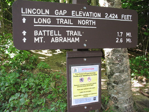
I first made my way up to the Lincoln Gap trailhead, where even the torquey TDI I drive had trouble on the 24% grade and the tight turns; I had to drop to 2nd gear to make it.   The Lincoln Gap road is the steepest paved road in America.   Of course some guys make a sport out of it - http://mountainpeakfitness.com/blog/2009-vt-6-gaps-ride !

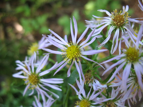
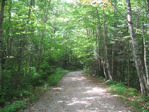
The trail is no cakewalk either.  1.8 miles to the shelter at around 2900 feet, with most of the gain coming in the middle third.   Still, a nice walk through hardwoods most of the way, I saw a cool bright green caterpillar (I think Orthosia hibisci), and a lot of mountain aster.


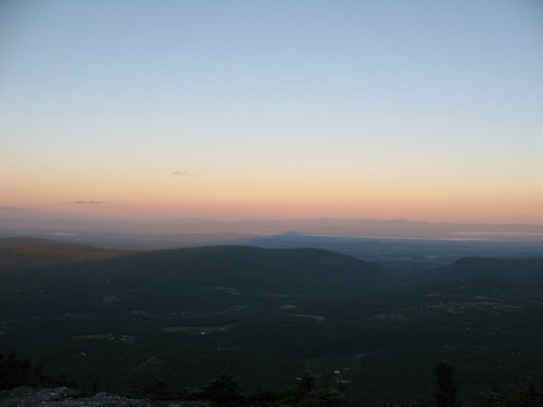
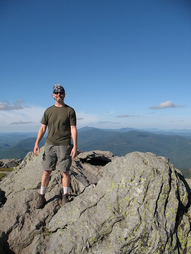
I stayed at the shelter, the Caretaker was off, probably recovering from a busy Labor Day weekend.  Two section hikers rolled in around 5:30, but pushed on, to bootleg camp on one of the ski slopes.  Up around dawn, I jumped on the trail and hit the summit a few minutes after sunrise.  In an area as hilly as the Green Mountains, sunrise comes to different places at much different times.


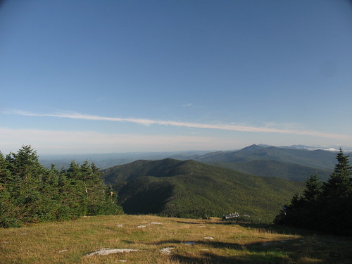
After this, I started the ridgewalk through some ski areas and a couple of tiny cols to make it over to Ellen.


The trails in VT are great - not so steep like Maine, but not so blown-out as the ones in NH or NY.  I think it's a combination of less traffic (since the mtns aren't so sexy and high), and good trail maintainers.  Very enjoyable to walk on, some places even have leaf-litter covering the trails.  Contrast that to the High Peaks region where there are beach-ball sized boulders in the trail (Looking your way, Van Hoevenburg!).

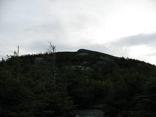
Packed back along the ridge and down to the car, the nice thing about hiking early is that the sun is low enough that when you retrace your steps, the trail has a totally different aspect.
Wound my way down the cowpaths to Bristol for lunch, then drove up to the Huntington side of Camel's Hump.  After all, I'd done 12 miles with full pack, I might as well knock off a few more!   After collecting my thoughts I opted to do it with a daypack and come back down - the camping on Camel's Hump is WAY off ridge in either direction (E or S), and I just couldn't make myself lose all that hard-earned elevation.

Camel's Hump was hard, I guess because I started off already tired, but it was just damn steep (2400 feet in 2.4 miles).  Still, terrific trail conditions made it a lot better.   On the summit I was besieged by flying ants - apparently they ride the thermals up the hill to mate on the summit.   The summit steward(ess?) was awesome.


Once I got back down, I shared a beer and war stories with a fellow ADK46er, then drove north to Underhill State Park, where I camped for $20.  Great place, super friendly Ranger, very knowledgeable about the trails.  They mandate leashed dogs and were SO into Leave No Trace that they told people to pack out their own poop.  Not from the park of course (they had portapotties) but from the trail.

Great trail map from the State of Vermont:

Next morning on the way up Mansfield started easily enough.


Then things got real on the Maple Ridge Trail up to the Forehead, topo map shows about 1500' in just over a mile.


Getting up to the Forehead, there was real weather rolling in from the East.   The ridgewalk became a subtle race against time as I could feel the normal thermals kicking up.


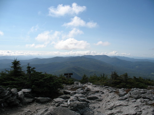
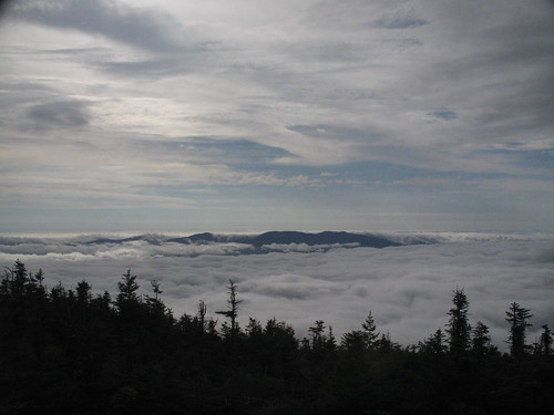
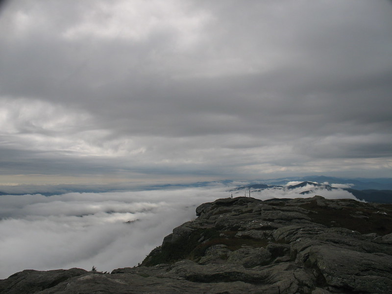
After a roadwalk past the visitor center area and gigantic radio antennae, I hit the Chin, completing my 4000 foot peakbags of VT.  Looking S, I could see the weather really coming in now.   What the still pic doesn't show is the "flow" of the clouds up and to the west (to the right):


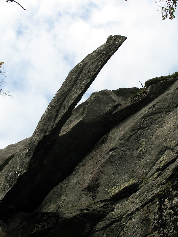
I hung out with the Summit Steward for a while, once again a great experience, the GMC knows their stuff.  Over the time I was there she went from wearing a Tshirt and shorts to pants, a long sleeve shirt, down jacket, hat, and scarf.  Finally, I was too freezing to stay so I headed down the Sunset Ridge Trail.   On the way there's a side trip to "Cantilever Rock" which is exactly that.


The picture doesn't really do it justice.  There's a nice flat lawn under it, a good place to take a break for lunch (tortilla and cheese).

A mile or so later, it was back on the Park road and the car.


I'm definitely heading back to VT for some of the other peaks, the people were great, the trails were great, and VT is a beautiful drive.

Friday, July 8, 2016

Trip Report: RI North South Trail

Over the holiday weekend I thru-hiked the Rhode Island North/South Trail, a 78 mile path from the Atlantic Ocean to the RI/MA border in Burrillville, RI.

Total time: approx 3.5 days
Total mileage: approx 80 miles including travel from the trailhead

If you JUST want pictures, the full album is here (on my personal server, ignore the self-signed cert warning):
https://vmeps.schernau.com/photos/main.php?g2_itemId=1851


Overall, a great time, I saw a lot of wildlife, encountered some nice people, saw some interesting relics of settlement, and got to really see the terrain and weather changes as you move away from the coast.   The biggest takeaway is that this is not a hike, it's a walk.   I could count the # of times I got out of breath due to terrain with one hand.  Walking this long on this kind of low elevation gain trails is more an exercise in blister and boot management, than it is a test of endurance.   Contrast this with a trip in the mountains of Maine or New York, where you're more often than not limited by your lungs.  At least I am, your mileage may vary.

There's a lot of roadwalking, I mean a lot, one stretch is over 11 miles.  If this is not your thing, then skip the trip.

If you can, find the Cliff Vanover book, available from Great Swamp Press.  You can do it without the book, or even without maps, but there's neat info in there, and has a good section for off-trail resources such as local campgrounds.  The signage is aggressive, overly so.   Instead of the 'double blaze' at trail forks, it's everywhere you make a turn, even if there's nowhere else to go.   It's often accompanied by a plastic N/S Trail sign, with arrows drawn on in marker.  You CANNOT get lost.

There's also no legal on-or-near-trail camping, except in the northern section where it goes right through a state campground.   Bootleg camping is not permitted.   I will leave this as an exercise to the reader.   As always, follow LNT principles.

Water can be a challenge.  I carried at most a gallon, and only dipped down into my emergency quart once.   There's only a few places where you can get free clean water, so carry at least something like iodine, and consider a water filter, as the water you find might be contaminated with suburban or rural runoff - oil, fertilizer, etc.

Day 1: Charlestown RI, the Blue Shutters Town Beach
I got dropped off at 6:30 at the beach parking lot.   The first few miles were a roadwalk through a nice neighborhood, complete with joggers and dogwalkers.   After a mile or two, my feet started to feel the pain of walking on asphalt.

The trail quickly moves into woods roads and state hunting/management areas, a mix of dirt road and trail.   At one point you pass through a sod farm.   The eerily flat/smooth soil and stench of nitrogen was unpleasant.


There's a nice pond/beach area at mile 11.93.

Day 1 ends with a long roadwalk, then a walk along the old highway, the New London Turnpike, now a dirt road under power lines, littered with trash like broken TVs.   From here the roar of I-95 is omnipresent.   You cross under it later, and for a while walk along it - at least its visible through some trees.


Shortly after this you enter the Arcadia Management area.
It was here I encountered trail magic!   A woman stopped her truck and gave me a fistful of "sweet fern", which when crushed and rubbed all over, repels mosquitoes and deerflies.

A note on bugs:
Deerflies, blackflies and mosquitoes are a constant challenge.   One thing I discovered is that by wearing a floppy straw hat that covers the ears, and good sunglasses, the deerflies cannot divebomb your ears, and the blackflies cannot fly into your eyes.   If you can steel yourself to hearing the deerflies endlessly circle, and the blackflies bouncing off your sunglass lenses, it's not too bad.

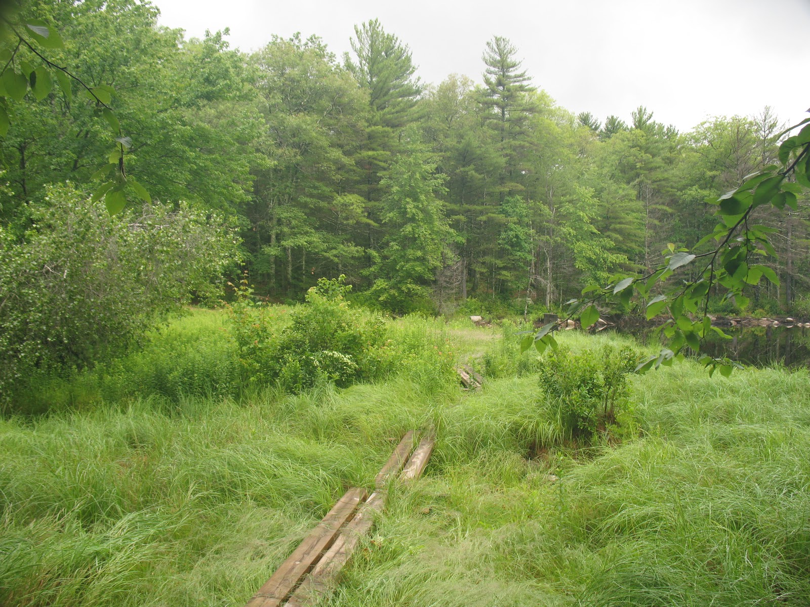
In the Arcadia Mgmt area, there's a beautiful pond/brook called Roaring Brook Pond.  This is at around mile 25.5.   One should always camp near a water source - but of course not too near!


Day 2:  Mostly Arcadia, then into Moosup Valley/Coventry/Foster
Arcadia is great, especially when there's not a lot of people.   Hiking through at 7am is a great time.   Hawks, deer, songbirds, and the bugs not too bad.
At Stepstone Falls I stopped and took a brief nap, and was amazingly recharged.   I think 10-15 minute naps are going to be my new thing.

Moving through and out of the area, I crossed through the old Escoheag Ski area.   There's some random machinery in the woods still, and here's the parking lot.


Then a long roadwalk, uphill.   But, after passing an area recently cleared to provide Cottontail habitat, I hit the halfway mark!

Through here, the gypsy moth caterpillar devastation is so great, it's winter.  Not only have they stripped the oaks, but the undergrowth/blueberry thickets as well.   Bears will go hungry, so people of western RI, lock up your trash extra tight.  I hate gypsy moths and tent caterpillars.


Coming out of here, some more walking and you cross the Moosup River on a high trestle bridge.   You're at about mile 40 here.  At this point the trail goes past a beautiful pond, Carbuncle Pond, where I took a nice long 2 hour break.   My feet were blistered heavily at this point, so I didn't swim, but I got all new water, and had a bit of a wash.

I live sort of near here, and at this point there's no state owned land for another 20 miles, so I pushed on, figuring I'd eat miles and walk as far as I could to split up the next 12 miles of roadwalk.  You pass through little hamlets like Rice City and Vaughn Hollow.
On the old Plainfield Pike (the other highway) I passed one of the old toll houses.  20 miles to Providence, if I wanted to walk there.


Trudging along (really trudging at this point, all roadwalks, 40+ miles in 2 days, just wanting to sit or sleep), I got to the historic village of Moosup Valley in Foster, where my ride awaited at mile 46.

Day 3:  Foster-Glocester (July 4)
More roadwalking, down 1 lane country roads and past farms.   You can tell its an election year.

At mile 53 you cross Interstate 6, the busiest road so far, but early morning it's not too bad.  At the Shady Acres restaurant I had a nice, shady break, complete with coffee, a muffin, and a tiny nap.   I got to watch a group of Revolutionary War re-enactors muster in the parking lot, then climb into a car and drive off somewhere.  A brief trip back into the woods by an old shingle mill, then its back onto the road for more miles.


Entering the Killingly Pond area, you cross into Connecticut briefly.   This park was awful, really beat up roads, nothing smooth, but nothing soft because its stripped to the rocks, and you walk through a "wonderful hemlock forest", which as everyone knows, is code for 'dark, mucky, and full of mosquitoes".

Emerging back onto the asphalt, I went through some rural neighborhoods until I got to the Oak Leaf Campground, at around mile 62.   At this point it was midday, and about 85 degrees, so I stopped at the camp store for some cold drinks.  An hour later, saddled back up and did the 4 mile trip through the Durfee Management area to the George Washington Management Area, at around mile 66.5.   Durfee was pretty bad, roads tough, muddy, and plagued by ATVs.

For $14 I got a campsite at the state campground at George Washington, and was then reminded of the perils of staying in a public campground on July 4.   Dogs, generators, and fireworks.   At this point I'd done 66 miles in 3 days, much of it on roads, and most of it in 80+ weather.  The blisters at this point were torn open and lets just say, painful.  

And then the rains came.   Fortunately I had some raingear, and had staked the tent well.   

Day 4: To the end

The rains lasted until around 9:30 on the morning of the 5th, at which point it started to get warm.   Dreading the combination of wet woods, hemlock groves, and 80 degree weather, I rebandaged my feet and saddled up.   Here the trail follows a set of other trails known as the Walkabout Trail, but thanks to the aggressive signage, you can't get lost.


Working through the Management Area, it started to feel a little more like hiking.  Some ups and downs, nothing major, but the terrain started to lose its sameness, and being off even a dirt road gave it a more rural feel.   The start and the end of the trail are definitely the best parts for that.


Coming out into another neighborhood and passing some powerlines, you come to the final road crossing, where you move into the Buck Hill Management Area.   This is the Maine of the trail - totally away from anything, steeper ups and downs, blueberry thickets, and bugs.

I got to a trail register, and knew I was nearly there.   Feet sore, hot, tired, I was instantly invigorated and pushed on.

Through more wet blueberry thickets (these untouched by caterpillars), I stumbled out onto a dirt road, and reached the end.


A two mile hike through the Management Area, past a neat wildlife marsh complete with beavers, and my ride awaited.

Final thoughts:

Would I do it again?   Probably not, certainly not the same way.   I might try to combine it with a bike ride.   The roadwalking really wasn't fun.   Not because of cars, or annoying dogs, simply because of the physical impact of walking on asphalt.

Glad I did it?  Absolutely.  I've wanted to do this since the trail was built.

Rhode Island is really a neat state.   Within 40 miles you have a capitol city full of universities, you have both the bay and ocean beaches, and you have some beautiful wooded areas to explore.  No real climbs, no summits, no real views except for in rare instances, but it's like going back in time.   At one point almost all of RI was cleared farmlands, now you see the cellar holes, the stone walls, and newer things like ski resorts that closed 40 years ago.   You get to walk through old hamlets like "Wood River Junction" and "Vaughn Hollow" where probably everyone knows everyone.  There's wildlife everywhere.   Best of all, if you're from here, getting to any of these trails or getting a ride back is an easy <1 hour drive.  Get out and go hiking!
Saturday, January 30, 2016

Barrel stove kit installed - syrup season here I come

Every year I gobble up a few tanks of propane making syrup from the maples on my property.  Because I have mostly red and swamp maple, whose sugar content is in the .5-1.5 percent range, I have to boil a lot of sap.

Side note: I've planted sugar maple saplings that I bought from the Arbor Day people, but that's 8-10 years out.

Given the massive amounts of wood, brush, and a stand of girdled trees that I've slowly been harvesting, I have "free" fuel.   Boiling my own sap with my own wood as fuel using recycled parts gives me "free" maple syrup, manages brush on my property, is carbon-neutral, and is a great hobby.

I purchased the Vogelzang barrel stove kit from Northern Tool, and today took advantage of the 40 degree (F) weather and installed it.   Total time about 2 hours, and I only cut myself on the sharp metal once.   The kit has the cast iron feet, front door and an adapter/damper for a 6" pipe.
Tools you will need:
Drill with a small and a 5/16" bit
Jigsaw/Sawzall with a metal cutting blade (or 2)
Magic marker for marking your cuts
Beefy phillips-head screwdriver
Cleverness at filling in the blanks on the instructions

Total cost: free barrel (but look on Craigslist, $25-40 is the norm), $51 for kit incl. shipping, 2 bags of play sand and 2 lengths of 6" pipe, total $80.

Instructions were good, not even chinglish, but left many small details out.   If you've built things and are handy this is not a problem.   If you are looking for IKEA-like detail, seek help or look elsewhere.

Ear plugs are a must.   One thing I found is that unless you punch all the holes first, they'll have a tendency to 'walk' while you're drilling, and nothing will line up.   What I did was get the parts on with 2 or 3 screws, then used the holes in the Vogelzang castings to line up the drill - everything went together perfectly.

Once assembled, I put a few inches of sand in the bottom and lit it up.   Worked like a charm, exactly as I had imagined it would.   At one point the surface temperature was 800 degrees (F).   It had a pretty funky paint smell for a bit.  I let it burn down, I'll scrape the charred paint off later, and maybe hit it with a can of stove paint.  Next step will be to attach a shelf to hold the pan of sap (stainless steel steam-table tray).   I can taste the syrup now.

Front attached:

Feet attached:

Chimney adapter attached

First firing (note the smoking paint)

Nice and warm!

Tuesday, January 26, 2016

Looking to improve your hiking performance? Drop some weight

Gear
Most people, even active people, could stand to lose a few pounds.   While there's a lot of time spent on gearmongering and swapping steel for titanium, let's look at what weighs what.  "A pound on the foot is like 5 on the back" they say.   What about "a pound off the belly is a pound off the back?"

Looking at my pack weight thread here and my Google docs spreadsheet for my base weight is just under 15 lbs.

Personally, I could lose 10 lbs.   That means I could add 10 lbs of food and water to my base weight, and do an overnight with essentially an empty pack.   That's huge!

Also, generally the process of losing weight is going to build up your strength, which means more miles, and more, BETTER miles.   You don't want to drag ass into camp at dusk, miserable and winded.   A light pack and fit legs are the best way to do this.  Spare energy and a good attitude go a long way towards making it easy to Leave No Trace.   You won't be tempted to take shortcuts, leave microtrash or food crumbs, if you've still got something left in the tank at the end of the day.

Water
I generally start off with a 70oz Platypus and whats left of breakfast in a Nalgene.   Combined that's about 5lbs of water.   Want to carry that for free?  Lose 5lbs - it's really not that hard.

This winter and spring the focus will be dropping weight, for higher performing summer hiking.

Monday, December 7, 2015

Leaving no trace in paradise

Digging through some old hiking photos from Hawaii, I was struck how similar the trail is to New England, despite having probably 1/100 of the traffic.   That volcanic soil just can't take the abuse, similar to the thin layer of soil on top of the mineral soils covering the mountains of the Northeast.  Just like how in alpine zones like Marcy, Washington, Saddleback and Katahdin one step off the trail does irreparable damage, the terrain on relatively 'new' land like the Hawaiian islands is fragile.

First you have jackasses like this.   Despite a marked trail, an easy trail that doesn't need poles, a sign to stay on the trail, these  two decided to take a break off the trail to adjust.   The terrain seems hardly fragile, but it's the sense of wildness you're looking to preserve.   If you end up with footbeds all over the lava, then its not a cool dormant crater anymore, its a city park.


On Kauai, in the Waimea Canyon park, there's a long trail that runs through jungle then along the coast.    Here you have a hip-deep trail, and a "bonus" trail along the side, probably created by sneaker-wearing hikers in the wet season.   If you #PlanAheadAndPrepare you have the right shoes.


When the trail is eroded like this, you want to stay on it - and you can see the subtle psychological pressure to keep away from the edge; the soil is getting compacted as the trail erodes.


These are the only legitimate ones allowed to go off-trail.   Partially because they live here, partially because they have four wheel drive.


It's important to leave the land in the condition you've found it, as you owe it to the guy behind you.   Let him have his experience, just as you had yours, and perhaps next time, someone will leave something for you.

Thursday, October 1, 2015

Hurricane!

Getting ready for Joaquin here on the farm.
  • Candles
  • Full tank of diesel in the car
  • Beer
  • Extra hay for the goats
  • Propane for the genny (more on that!)
  • Charging the phones and tablets


We have a good 6kW propane powered generator.   It's your standard Chinese clone, but it does put out 220, so I've piped it into the house and we have all the basics covered - heat (if needed), hot water, well, sewer pump, fridge.   If we do lose power I estimate about 24 hours continuously at 1/2 load given our propane supply.   Next year I'll move the circuit to the top of the panel, and we'll have everything powered.

What I discovered today is that some sort of insect decided to nest in the tube connecting the gas fitting to the carb.   Of course that was AFTER I pulled the plug twice, tested for spark, went and got a battery so I could use electric start... nothing, except a bunch of goop in the fuel line.

Disassembled the fuel line, ran a rat-tail file down it a few times to clean out the crud, and shazam, 6kW of sweet, sweet power.

Moral: if you keep your generator outside, plug up all the holes.

The animals will all be inside - the stall doors bolt, and I'm tying the main doors closed to prevent them acting like a sail.   The chickens should be fine, it's not cold enough yet for the wind to be a factor inside the barn.


Tuesday, August 18, 2015

Heirloom apples, heirloom cider

I have 3 ancient apple trees, and they're starting to drop.   All have seen better days, and the gypsy moths hit one of them pretty hard.   Before the apples really get gross on the ground (and become goat food) I've started scavenging them.  It's a nice tradeoff between losing a few to rot and not having to do the work to pick them.   The trees give me them when they're ready.   Strangely, the sickest looking tree, the oldest and wisest one, also has the most obviously ripe apples up top - either that or it has fewer leaves to conceal the apples.

You won't get apples like this in the store, because they're small and gross, but they're 100% organic, and free.

If anyone reading this knows what kind they are, I'd appreciate the info.   I'm thinking macintosh, and something else, the stripey ones are definitely different apples.

After trimming the gross bits off and running them through the Breville, I get this:

Probably 6 ounces after pouring off the foam.   I'll lose a little more when it settles, too.   If I get an entire gallon, I'll count myself lucky.   I'll add some ale yeast later, and then race it against some unpasteurized cider I get from a local orchard (http://www.phantomfarms.com/) to see which comes out the best.   Hint: if you use champagne yeast you get a deadly combination of apple, bubbles, and super high ABV.   Be prepared for a nap after drinking.   That's why I go with ale yeast, I want something around 6%.

Saturday, August 15, 2015

Late summer - Let the Canning begin!

The cherry tomatoes are going full speed these days, so I took 4 quarts of them and decided to save them as sauce.   Since I'm the only one eating it, I get to make it how I like.

All fresh from the garden this year, I'm doing:
yellow cherry tomatoes
a few red tomatoes that happened to be ripe

yellow squash
zucchini
red onion
basil
garlic
olive oil

The olive oil is the only thing I couldn't make myself.   Maybe when I finish the grape jelly in a few weeks, I could try making grapeseed oil.... but probably not.

Given that there's non-tomato stuff in the sauce, I figured I'd need to pressure can it, so I skipped the vinegar/lemon juice.


Half the batch, with the pressure cooker warming up in the back.   Electric stoves just don't have the punch that gas ones do.   It took around 20 minutes to go from boiling up to 10psi.


I ended up with quarts of sauce, a little watery since I didn't simmer it down endlessly (not wanting to mush the zucchini).

Growing your own food and canning it is a great way to reduce your Trace - you can use your own composted scraps as soil ammendment, the vegetables don't travel via truck anywhere, you're reusing the canning jars, and come winter you have a healthy sauce (all my stuff is organic) with no extra sugar, thickeners, or crap.


Thursday, August 6, 2015

Rhubarb Wine III: The Drinking

Poured off a cup, it tastes like cheap white wine.   Thin.   Almost no rhubarb taste or smell.

Wine: 1
Ed: 0

Next up, wine from the concord grapes all over the property.   Last summer I put up about 4 quarts of jam, and we have leftovers, and I gave some away, so I clearly don't need this many grapes.

Monday, August 3, 2015

A time to cut, a time to buck, a time to split and a time to stack

The first foggy cool morning of the summer reminded me that it won't last forever, so I've been trying to get the woodpile sorted.   I have about 2 cords set up so far, and another cord in the big pile that's starting to season.  I enjoy cutting and splitting the wood, the smell and feel of it, it's good exercise, and the idea that I'm recycling the carbon that I just exhaled makes me smile.

It's funny how people sell "semi-seasoned" wood - hint: if it's not seasoned, it's green.   The wood guy, nice guy, good price, good wood, delivered a mostly oak cord at about 28% MC inside the splits.  It should at least burn this fall, perhaps not well, but I do get a lot of sun and a strong crosswind.

Here's the small pile, with some big rounds submerged in it that I don't want to think about splitting just yet.
(Yes that's the old outhouse down the hill)

Stacked carelessly around are the bits of wood and fenceposts which help form my tarp system which I'll implement come November.   The composter isn't part of the system, it was just in the way.

Fully loaded and squared, this will be about 4 cords - 4 rows of splits, 4' high and 24' long.
Note that a cord is 128 cubic feet, generally stacked in 3 rows of 16" splits, 4' high and 8' long.  The rows of splits should be stacked with space enough for a squirrel to pass through, but not enough for the cat behind it.   This is mostly maple, with some oak, white pine and white birch mixed in.

The big pile up the hill will be another 5 cords.  If can I can burn 4 cords over the winter, I burn almost no oil, save that what I need for hot water.   I usually burn hard until I have about 1/2 cord left, then depending on the season, put the brakes on, leaving that as my emergency, you-have-no-heat scenario.   I have a genny for the furnace, but it's loud and irritating.

I had some apple that I cut this spring, bucked and stacked but not split.   I tested the ends of the rounds with the moisture meter and got about 9%.   I tested by piercing the bark and got almost 50%.   Splitting one 4" round, the inside was at 30%.   The pieces were so small, I assumed I wouldn't need to split them, but given that, it looks like I'll have to.   You should be at 10-20% MC.   Too dry and the wood burns too fast and hot, too wet (above 20) and it hisses.  Above 25 and you boil sap out the ends!

Apple, glorious, fragrant, high BTU apple - cut from my reclaimed heirloom trees:

Some links which I've found useful:
http://mb-soft.com/juca/print/firewood.html

I'd add my affiliate link to the Amazon page for the moisture meter that I bought, but they wouldn't let me.  A good one shouldn't be more than $30.   Google it.

I love to talk firewood, ask me any questions.

Thursday, July 9, 2015

Adirondack Trip - Street, Nye, Allen and Cliff


This past weekend I knocked off 4 more of the High Peaks, all "trailless" - which means no signs, and no maintenance, but hardly a bushwhack.

Pics are here:
https://vmeps.schernau.com/photos/main.php?g2_itemId=1545

I started parked at South Meadows about a mile from the Adirondak Loj, hiked the road, then climbed up Street & Nye.   Generally an uninspiring, easy hike, there was an interesting ford required due to high water and recent rain.   Fords are always fun, especially ones where the blackflies are not devouring you as you precariously cross.   Minimal view, and plenty of insects once you stopped moving.   Met a few people.  The nice thing about using a small daypack is that you can travel fast and light, I actually snuck up on someone sitting eating lunch I was moving so smoothly.

Got back to the car by about 6, decided not to camp as it looked wet.   Drove to the Hostel in Keene Valley where I've stayed many times, and crashed late, after staying up talking to some rock climbers.

Next day drove way around to the Works in Newcomb, parked the car, and began the start of the 16 mile day including Allen, and ending at the Flowed Lands.   Several significant fords, and the most schizophrenic trail I've hiked - alternating sections of smooth old woods road, and 20' wide muddy quagmires.  Once you hit the slide, you're walking up bare rock, or better, bare rock with water flowing over it.  I wiped out significantly only once.   Minimal view, and horrific bugs at the top.

Back down and across another ford, and a long gradual slog uphill to the Flowed Lands, where the last and biggest ford awaited.

Camped near the Flowed Lands Lean-To, then early in the morning daypacked up Opalescent Brook to Cliff - another muddy, trailless mess.   Socked in completely with clouds and fog, it was a fun climb with some interesting rock scrambles.

Back down the old closed trail and another ford down Calamity Brook, did some skinny-dipping and de-funkifying, and got back to the car in time to drive to Keene Valley for dinner.

5 stars, would do again (maybe sometime)


Saturday, July 4, 2015

Weighed in the scales and (not?) found wanting

Heading up to the Adirondacks again, and I thought I'd weigh in, literally.   We bought a kitchen scale recently to help with big batches of canning, and it has a good capacity and resolution.   And its a quiet, hazy afternoon, nothing better than getting your gear sorted.


(Jake the Wonder Dog assisting)


Short version: Base weight = just under 14 lbs, although I didn't include water carrying - my 70oz camelback, my 1L Platypus and my 1L nalgene.   Google tells me that these weigh approx 5oz, 1oz and 6oz respectively. Adding this all in pushes it up close to 14lbs.  Factoring in a few odds and ends and my car keys & wallet, lets call it 15lbs.   Not bad.   It doesn't include clothes, but the only things generally that sit in the pack are a pair of extra socks, a knit hat, and a rain jacket.  If you don't wear it daily, it's a waste.

I've included a link to my pack list on a Google Spreadsheet here:
https://docs.google.com/spreadsheets/d/1oCVW3B8WjOjlplQMycklFiQ-qJs_H5toccit7ec3vck/edit?usp=sharing

This includes both my stove and my bear cannister @ 2lbs11oz (heaviest thing I have).   When packing up in the Adirondacks, the Eastern High Peaks zone requires bear cannisters for overnight camping, so I leave the stove at home.   The other option you have is only do day-hikes, but there's something magical waking up in the mountains in the middle of the night, or being able to hit the trail at 5am.

Keeping your pack weight down is an important part of being a responsible hiker - you're less likely to get tired, less likely to 'cheat' and grab at trees or widen muddy areas, less likely to get hurt and need rescue, and you're bringing less trash which could be left behind.   Slipping quietly along the trail and creating a minimalist campsite (small tent, muted colors, little or no cooking) means that you're not affecting the animals or others seeking their own experience.