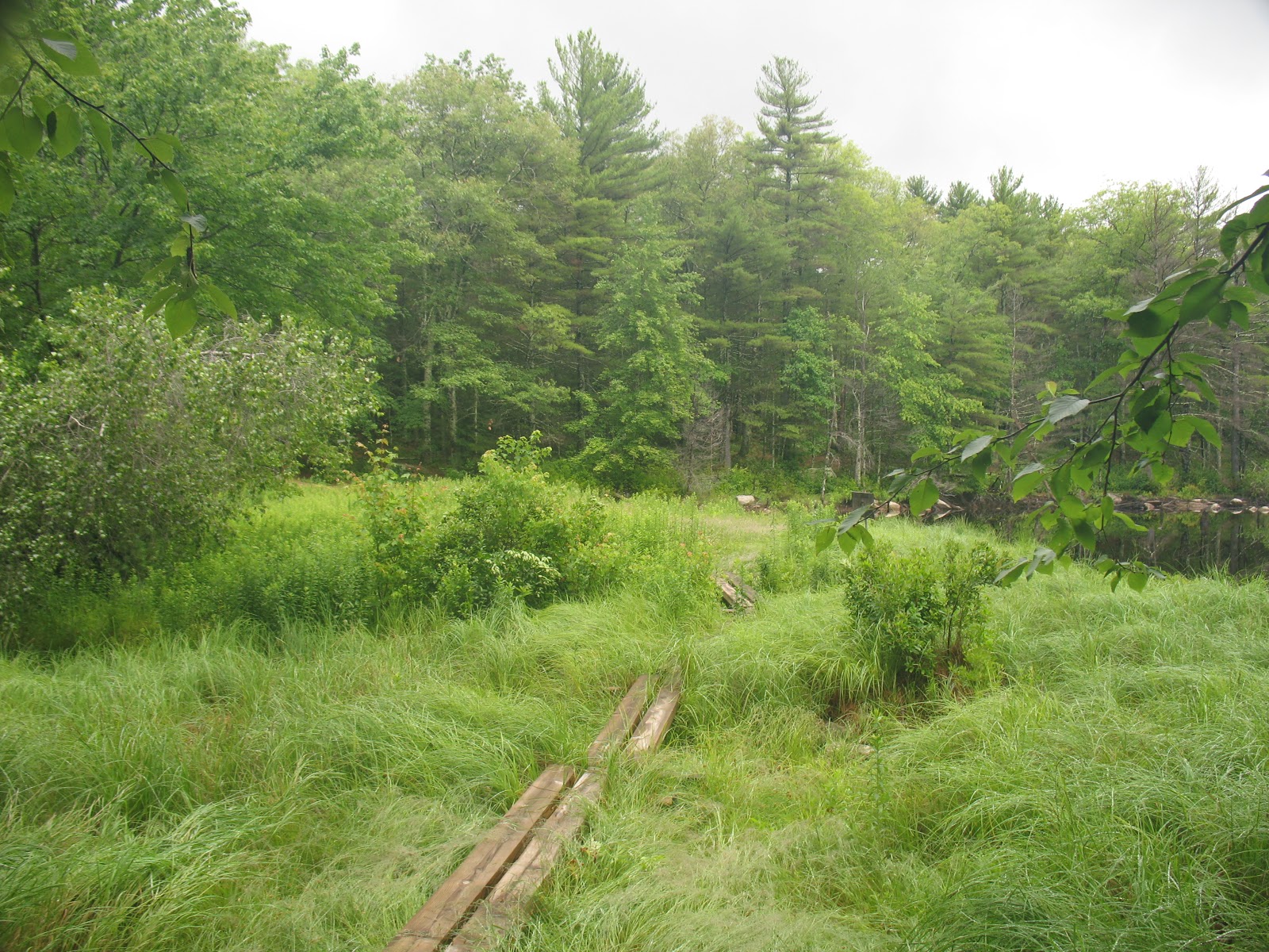
Over the holiday weekend I thru-hiked the Rhode Island North/South Trail, a 78 mile path from the Atlantic Ocean to the RI/MA border in Burrillville, RI.
Total time: approx 3.5 days
Total mileage: approx 80 miles including travel from the trailhead
If you JUST want pictures, the full album is here (on my personal server, ignore the self-signed cert warning):
https://vmeps.schernau.com/photos/main.php?g2_itemId=1851
Overall, a great time, I saw a lot of wildlife, encountered some nice people, saw some interesting relics of settlement, and got to really see the terrain and weather changes as you move away from the coast. The biggest takeaway is that this is not a hike, it's a walk. I could count the # of times I got out of breath due to terrain with one hand. Walking this long on this kind of low elevation gain trails is more an exercise in blister and boot management, than it is a test of endurance. Contrast this with a trip in the mountains of Maine or New York, where you're more often than not limited by your lungs. At least I am, your mileage may vary.
There's a lot of roadwalking, I mean a lot, one stretch is over 11 miles. If this is not your thing, then skip the trip.
If you can, find the Cliff Vanover book, available from Great Swamp Press. You can do it without the book, or even without maps, but there's neat info in there, and has a good section for off-trail resources such as local campgrounds. The signage is aggressive, overly so. Instead of the 'double blaze' at trail forks, it's everywhere you make a turn, even if there's nowhere else to go. It's often accompanied by a plastic N/S Trail sign, with arrows drawn on in marker. You CANNOT get lost.
There's also no legal on-or-near-trail camping, except in the northern section where it goes right through a state campground. Bootleg camping is not permitted. I will leave this as an exercise to the reader. As always, follow
LNT principles.
Water can be a challenge. I carried at most a gallon, and only dipped down into my emergency quart once. There's only a few places where you can get free clean water, so carry at least something like iodine, and consider a water filter, as the water you find might be contaminated with suburban or rural runoff - oil, fertilizer, etc.
Day 1: Charlestown RI, the Blue Shutters Town Beach
I got dropped off at 6:30 at the beach parking lot. The first few miles were a roadwalk through a nice neighborhood, complete with joggers and dogwalkers. After a mile or two, my feet started to feel the pain of walking on asphalt.
The trail quickly moves into woods roads and state hunting/management areas, a mix of dirt road and trail. At one point you pass through a sod farm. The eerily flat/smooth soil and stench of nitrogen was unpleasant.
There's a nice pond/beach area at mile 11.93.
Day 1 ends with a long roadwalk, then a walk along the old highway, the New London Turnpike, now a dirt road under power lines, littered with trash like broken TVs. From here the roar of I-95 is omnipresent. You cross under it later, and for a while walk along it - at least its visible through some trees.
Shortly after this you enter the Arcadia Management area.
It was here I encountered trail magic! A woman stopped her truck and gave me a fistful of "sweet fern", which when crushed and rubbed all over, repels mosquitoes and deerflies.
A note on bugs:
Deerflies, blackflies and mosquitoes are a constant challenge. One thing I discovered is that by wearing a floppy straw hat that covers the ears, and good sunglasses, the deerflies cannot divebomb your ears, and the blackflies cannot fly into your eyes. If you can steel yourself to hearing the deerflies endlessly circle, and the blackflies bouncing off your sunglass lenses, it's not too bad.
In the Arcadia Mgmt area, there's a beautiful pond/brook called Roaring Brook Pond. This is at around mile 25.5. One should always camp near a water source - but of course not too near!
Day 2: Mostly Arcadia, then into Moosup Valley/Coventry/Foster
Arcadia is great, especially when there's not a lot of people. Hiking through at 7am is a great time. Hawks, deer, songbirds, and the bugs not too bad.
At Stepstone Falls I stopped and took a brief nap, and was amazingly recharged. I think 10-15 minute naps are going to be my new thing.
Moving through and out of the area, I crossed through the old Escoheag Ski area. There's some random machinery in the woods still, and here's the parking lot.
Then a long roadwalk, uphill. But, after passing an area recently cleared to provide Cottontail habitat, I hit the halfway mark!
Through here, the
gypsy moth caterpillar devastation is so great, it's winter. Not only have they stripped the oaks, but the undergrowth/blueberry thickets as well. Bears will go hungry, so people of western RI, lock up your trash extra tight.
I hate gypsy moths and tent caterpillars.
Coming out of here, some more walking and you cross the Moosup River on a high trestle bridge. You're at about mile 40 here. At this point the trail goes past a beautiful pond, Carbuncle Pond, where I took a nice long 2 hour break. My feet were blistered heavily at this point, so I didn't swim, but I got all new water, and had a bit of a wash.
I live sort of near here, and at this point there's no state owned land for another 20 miles, so I pushed on, figuring I'd eat miles and walk as far as I could to split up the next 12 miles of roadwalk. You pass through little hamlets like Rice City and Vaughn Hollow.
On the old Plainfield Pike (the other highway) I passed one of the old toll houses. 20 miles to Providence, if I wanted to walk there.
Trudging along (really trudging at this point, all roadwalks, 40+ miles in 2 days, just wanting to sit or sleep), I got to the historic village of Moosup Valley in Foster, where my ride awaited at mile 46.
Day 3: Foster-Glocester (July 4)
More roadwalking, down 1 lane country roads and past farms. You can tell its an election year.
At mile 53 you cross Interstate 6, the busiest road so far, but early morning it's not too bad. At the Shady Acres restaurant I had a nice, shady break, complete with coffee, a muffin, and a tiny nap. I got to watch a group of Revolutionary War re-enactors muster in the parking lot, then climb into a car and drive off somewhere. A brief trip back into the woods by an old shingle mill, then its back onto the road for more miles.
Entering the Killingly Pond area, you cross into Connecticut briefly. This park was awful, really beat up roads, nothing smooth, but nothing soft because its stripped to the rocks, and you walk through a "wonderful hemlock forest", which as everyone knows, is code for 'dark, mucky, and full of mosquitoes".
Emerging back onto the asphalt, I went through some rural neighborhoods until I got to the Oak Leaf Campground, at around mile 62. At this point it was midday, and about 85 degrees, so I stopped at the camp store for some cold drinks. An hour later, saddled back up and did the 4 mile trip through the Durfee Management area to the George Washington Management Area, at around mile 66.5. Durfee was pretty bad, roads tough, muddy, and plagued by ATVs.
For $14 I got a campsite at the state campground at George Washington, and was then reminded of the perils of staying in a public campground on July 4. Dogs, generators, and fireworks. At this point I'd done 66 miles in 3 days, much of it on roads, and most of it in 80+ weather. The blisters at this point were torn open and lets just say, painful.
And then the rains came. Fortunately I had some raingear, and had staked the tent well.
Day 4: To the end
The rains lasted until around 9:30 on the morning of the 5th, at which point it started to get warm. Dreading the combination of wet woods, hemlock groves, and 80 degree weather, I rebandaged my feet and saddled up. Here the trail follows a set of other trails known as the
Walkabout Trail, but thanks to the aggressive signage, you can't get lost.
Working through the Management Area, it started to feel a little more like hiking. Some ups and downs, nothing major, but the terrain started to lose its sameness, and being off even a dirt road gave it a more rural feel. The start and the end of the trail are definitely the best parts for that.
Coming out into another neighborhood and passing some powerlines, you come to the final road crossing, where you move into the Buck Hill Management Area. This is the Maine of the trail - totally away from anything, steeper ups and downs, blueberry thickets, and bugs.
I got to a trail register, and knew I was nearly there. Feet sore, hot, tired, I was instantly invigorated and pushed on.
Through more wet blueberry thickets (these untouched by caterpillars), I stumbled out onto a dirt road, and reached the end.
A two mile hike through the Management Area, past a neat wildlife marsh complete with beavers, and my ride awaited.
Final thoughts:
Would I do it again? Probably not, certainly not the same way. I might try to combine it with a bike ride. The roadwalking really wasn't fun. Not because of cars, or annoying dogs, simply because of the physical impact of walking on asphalt.
Glad I did it? Absolutely. I've wanted to do this since the trail was built.
Rhode Island is really a neat state. Within 40 miles you have a capitol city full of universities, you have both the bay and ocean beaches, and you have some beautiful wooded areas to explore. No real climbs, no summits, no real views except for in rare instances, but it's like going back in time. At one point almost all of RI was cleared farmlands, now you see the cellar holes, the stone walls, and newer things like ski resorts that closed 40 years ago. You get to walk through old hamlets like "Wood River Junction" and "Vaughn Hollow" where probably everyone knows everyone. There's wildlife everywhere. Best of all, if you're from here, getting to any of these trails or getting a ride back is an easy <1 hour drive. Get out and go hiking!